Snoqualmie Pass — Backcountry
Slot Couloir, Guye Peak, The Twins, Lundin Peak, Kendall Trees, and more — conditions, tours, and avalanche resources.
beExploring / Snoqualmie Pass
Snoqualmie Pass sits at 3,022 ft along I-90 — low by Cascade standards, but close enough to Seattle to draw a large backcountry crowd. The pass is known for its density of objectives relative to approach time: the Slot Couloir on Snoqualmie Mountain, The Twins in the Kendall Adventure Zone, and the lower-angle touring in Commonwealth Basin can all be reached in a day from the city.
The tradeoff is elevation and exposure to maritime weather. Rain at pass level is common during winter storms, and the snowpack reflects it — variable, often wind-affected, and worth treating conservatively. On the right day with a solid NWAC forecast, Snoqualmie backcountry is as good as anything in the Cascades.
beExploring / Snoqualmie Pass
Most iconic line
Slot Couloir on Snoqualmie Mountain — the most popular backcountry ski at the pass
Best short approach
Guye Peak East Couloir — technical descent with the shortest approach of any couloir at the pass
Best storm day
Kendall Trees — protected glades off Kendall Peak, skiable when the couloirs are wind-affected
Best spring objective
Lundin Peak — south-facing couloir that corns up well, best in stable spring conditions
Always check first
NWAC Snoqualmie Pass avalanche forecast — every worthwhile tour here involves avalanche terrain
beExploring / Snoqualmie Pass
Virtually every worthwhile objective at Snoqualmie Pass involves avalanche terrain. The NWAC Snoqualmie Pass zone forecast is updated daily — treat it as mandatory reading before any tour.
Alpental requires a Summit at Snoqualmie parking pass. Gold Creek Sno-Park requires a Washington Sno-Park permit. Commonwealth Basin has no permit requirement — park roadside along the highway, though spots fill quickly on busy weekends; Summit at Snoqualmie lots are the fallback.
At 3,022 ft, Snoqualmie Pass sits near the rain-snow line. Warm Pacific storms regularly dump rain at the pass while surrounding peaks get snow. Check temperatures and know what you're heading into.
beExploring / Snoqualmie Pass
Snoqualmie Mountain — Alpental
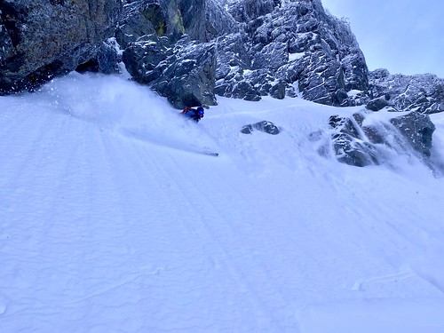
The Slot Couloir on Snoqualmie Mountain is the most popular backcountry line at the pass — a direct, aesthetic ski with a no-nonsense approach from the Alpental lot. The entrance sits around 6,000 ft and the north aspect holds cold snow well after storms. It sees heavy traffic, but the skiing is worth it regardless. The approach slope is steep and often wind-affected, so solid avalanche assessment is essential.
Guye Peak — Snoqualmie Pass
Guye Peak's east couloir has the shortest approach of any technical descent at the pass, and it sees far less traffic than the Slot. The entrance is steep and narrow, opening up a bit after the first 50 feet into a sustained pitch back down to the pass. A solid option for days when you want a technical line without a long approach.
Chair Peak — Alpental
The North Shoulder of Chair Peak offers terrain that looks unlike most of the pass — gentle undulating slopes that feel more like a glacier than a Cascade couloir, before the terrain drops away in a cliff band above Snow Lake. It shares the Alpental approach with the Slot Couloir and is a more moderate alternative, though the north aspect and elevation still demand careful snowpack reading.
Kendall Adventure Zone — Gold Creek
The Silver Twins are two north-facing couloirs in the Kendall Adventure Zone that drop into Silver Creek Basin, each delivering about 1,000 ft of consistent pitch. The skier's right couloir runs tight against a large rock wall; both start steep in a well-defined slot and ease as you descend. Excellent on a powder day. Access is from Gold Creek Sno-Park via the PCT — a Washington Sno-Park permit is required.
Snoqualmie Mountain — Alpental
The Circus and Crooked Couloirs sit on the backside of Snoqualmie Mountain, sharing the general Alpental approach but offering a quieter alternative to the Slot. The Crooked Couloir spans a range of aspects and is prone to wind effect at the top; the Circus is more sheltered and protected. At 10 miles round trip with 6,000 ft of gain, this is one of the bigger days at the pass.
Commonwealth Basin
Lundin Peak's south-facing couloir is visible from the Summit West base area on clear days. The couloir starts with a solid pitch and sustains for about 1,200 vertical feet before easing off. The south aspect makes this primarily a spring objective — it corns up reliably once stable melt-freeze cycles set in, and is a good choice when the north-facing lines are in poor shape.
Alpental
After ski operations close at Alpental, the mountain often holds enough snow for a spring ski tour. The standard route skins up the Armstrong lift line to Chair 2, continuing to the top and beyond if conditions allow. A low-commitment option when you want to ski familiar terrain without committing to a technical backcountry objective.
Kendall Peak — Commonwealth Creek
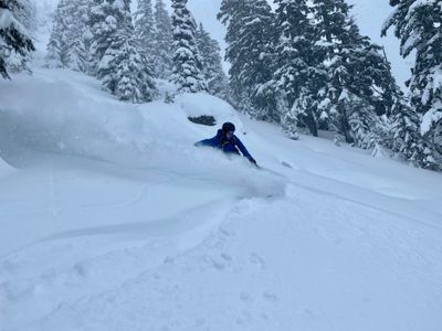
The Kendall Trees is the forested terrain rising from Commonwealth Creek along the eastern slopes of Kendall Peak. Well-spaced trees and a protected aspect make it a reliable storm-day and high-hazard-day option when the couloirs aren't worth the risk. It's often skied as a bonus on the way out from Kendall Adventure Zone tours, but holds up fine as a standalone objective.
beExploring / Snoqualmie Pass
The previous 7 days use telemetry from two NWAC stations: precipitation, temperature, and snow depth from the Snoqualmie Pass station at 3,010 ft, and wind data from the Alpental Summit station at 5,470 ft. The next 7 days are a localized NWS forecast for the pass.
beExploring / Snoqualmie Pass
Avalanche forecasts for Snoqualmie Pass are provided by the Northwest Avalanche Center (NWAC) and typically updated at 6pm for the following day. Check the full forecast at nwac.us before any backcountry tour.
beExploring / Snoqualmie Pass
Use these WSDOT cameras to check pass-level conditions before heading up. Both cameras sit near the main backcountry access points.
Near Hyak Sno-Park at ~2,500 ft elevation
Summit East base area at ~2,600 ft elevation