
Stevens Pass — Backcountry
Backcountry Skiing
Stevens Pass
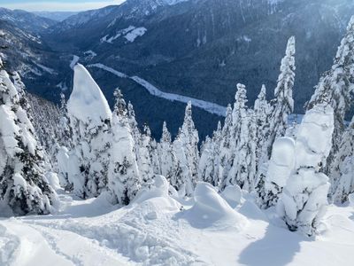
Yodelin, Skyline, and the ridges above Highway 2 — conditions, tours, and avalanche resources.
beExploring / Stevens Pass
Overview
Stevens Pass sits at 4,061 ft along Highway 2 — high enough to stay above the rain-snow line on most winter days, and close enough to Seattle (about 1.5 hours) to draw a steady backcountry crowd. The main touring areas are Yodelin, a former ski area 1.7 miles east of the resort with mixed terrain, and Skyline, a short tour accessible directly from the ski resort parking lot.
Neither area has the density of objectives found at Snoqualmie or Crystal, but both offer reliable winter skiing with manageable approaches. Yodelin's moderate-angle terrain makes it particularly useful on higher-hazard days when steeper objectives aren't worth the risk.
beExploring / Stevens Pass
Backcountry at a Glance
Most popular area
Yodelin — former ski area with mixed terrain, good for conservative avalanche days
Quickest tour
Skyline — 2-mile round trip accessed directly from Stevens Pass Ski Area parking
Best tree skiing
Yodelin's Backside Glades — lower-angle trees down toward Mill Creek
Always check first
NWAC West Slopes North forecast — most terrain here carries avalanche exposure
beExploring / Stevens Pass
Before You Go
Avalanche Terrain
Even Yodelin's more moderate slopes carry slide potential. The NWAC Stevens Pass zone forecast is updated daily — read it before every tour. The Skyline area includes steeper terrain near the Highway Chutes that demands careful assessment.
Parking
Yodelin has a free lot off Highway 2, about 1.7 miles east of the ski resort. The Skyline tour starts from Stevens Pass Ski Area lots G or C — on weekends and holidays these are typically reserved for carpools of 4+ people.
Elevation Advantage
Stevens Pass sits at 4,061 ft — considerably higher than Snoqualmie Pass and consistently above the rain-snow line during most winter storms. Snow quality at Stevens tends to be more reliable through the season.
beExploring / Stevens Pass
Ski Tour Areas
1.7 miles east of Stevens Pass Resort
Yodelin
Yodelin is the go-to backcountry area at Stevens Pass, drawing a mix of beginner tourers and experts looking for low-consequence terrain on high-danger days. The area opened as a ski resort in 1969 but closed after a tragic 1974 avalanche across the highway — remnants of old lift towers and runs are still visible. From the parking lot, skin up on the south side of the main building to find a road grade that winds toward the ridge. From there, runs like Shakedown and Center Bowl descend the front, while the saddle opens access to Big Trees and the Backside Glades toward Mill Creek. The backside requires skinning back up.
- Free parking lot on Hwy 2
- Beginner to advanced terrain
- Good for conservative avalanche days
Stevens Pass Ski Area — Lots G or C
Skyline
The Skyline area is a short, accessible tour directly from the Stevens Pass Ski Area parking lot. The route follows a forest service road past cabins and under power lines, climbing toward the radio tower at Skyline Ridge. Once at the ridge, options include Short N Sweet and the steeper Highway Chutes. The return is a ski-out on snow-covered Tye Road back to the parking lot. At just 2 miles round trip and 1,100 ft of gain, it's one of the quickest ways to get turns in at Stevens on a tight schedule.
- Lots G or C at Stevens Pass Ski Area
- Carpool requirement on weekends/holidays
- 2 miles round trip, 1,100 ft gain
beExploring / Stevens Pass
Conditions
Observed conditions use NWAC telemetry from the Stevens Pass area. The extended forecast draws from the NWS grid point above the pass. Use these together with the NWAC forecast to assess current snowpack and approach conditions.
beExploring / Stevens Pass
Avalanche Forecast
Avalanche forecasts for Stevens Pass are provided by the Northwest Avalanche Center (NWAC) and typically updated at 6pm for the following day. Check the full forecast at nwac.us before any backcountry tour.
beExploring / Stevens Pass
Webcams
Stevens Pass Ski Resort cameras give a quick read on current conditions at and above the pass before heading out.
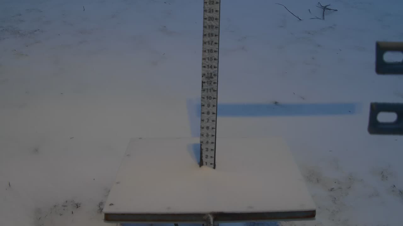
Base area snow depth reference
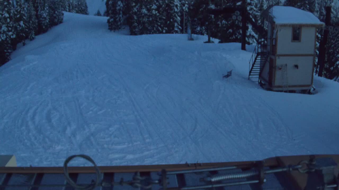
Mid-mountain view from Jupiter lift

Base lodge and lower mountain conditions
beExploring / Stevens Pass