Click on an item on the map to view information about it
beExploring · Trip Reports · Washington · Manson
4th of July Mountain
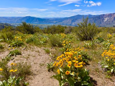
A short but rewarding climb above Manson with spectacular Lake Chelan views and abundant spring wildflowers. The 3.2-mile round trip packs in 1,200 feet of elevation gain, satisfying without committing to a full-day a…
Plan This Trip
At a Glance
straighten
Distance
3.2 miles, roundtrip
trending_up
Elevation Gain
1,200 ft
landscape
High Point
3,548 ft
backpack
Activity
Hike
Best For
Lake ViewsWildflowersDogs AllowedNo Pass RequiredMid-DistancePhoto Highlights · April 2026
Jump to Trip Report →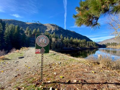
Plan This Trip
Why Go
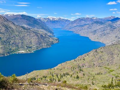
This is definitely one of the better hikes in the Lake Chelan area, rewarding hikers with outstanding views of Lake Chelan from the top. This hike is a 20 minute drive from “downtown” Manson, and would be easy to pass by with an unassuming trailhead a ways off the road, no real parking lot to speak of, and few visitors.
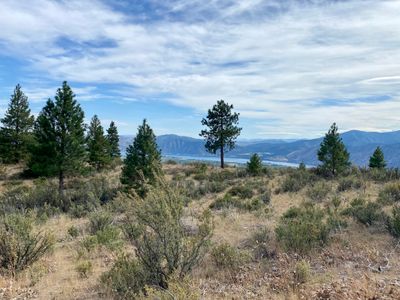
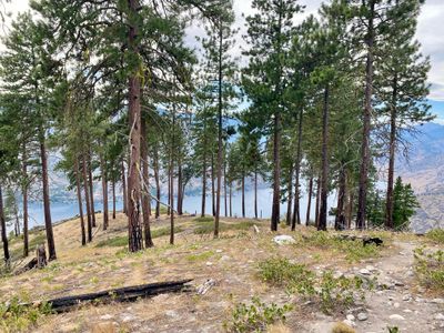
The start of the hike begins once you cross the Lake Antilon dam, and quickly begins ascending through the forest. You quickly exit the forest and traverse along the side of Fourth of July Mountain until reaching a ridge, at which point you will catch your first views of Lake Chelan. As you progress up the ridge, you’ll have better views of Lake Chelan, as well as Wapato, Roses, and Dry Lakes. Upon reaching the top, proceed a little farther north for expansive views of Lake Chelan.
The start of the hike begins once you cross the Lake Antilon dam, and quickly begins ascending through the forest. You quickly exit the forest and traverse along the side of Fourth of July Mountain until reaching a ridge, at which point you will catch your first views of Lake Chelan. As you progress up the ridge, you’ll have better views of Lake Chelan, as well as Wapato, Roses, and Dry Lakes. Upon reaching the top, proceed a little farther north for expansive views of Lake Chelan.
Placeholder in dev for ad
Plan This Trip
Route & Map
Plan This Trip
Getting There
directions_car
Directions
Drive on WA-150/W Manson Rd towards Manson, and turn right on Wapato Point Road for 2.3 miles. Turn right onto Upper Joe Creek Road and after 2.2 miles continue on Grade Creek Road. After 1.7 miles, keep left to continue on Grade Creek Road and in .9 miles you will see the Antilon Lake dam.
local_parking
Parking
There is no parking area, however there are a couple of small pull-offs on the side of the road to park your car. No parking passes are required.
edit_note
Field Notes · Personal Trip Report
3
Trip Reports
I've hiked 4th of July Mountain 3 times — pick a visit to read its full report.
Pack Breakdown
My son tackled the climb in my mother's overnight pack for the first time, and by the ridge he'd found his stride despite the weight.
calendar_today April 26, 2026
straighten 2.9 miles, roundtrip · 1,370 ft gain
chat 0 comments
There were quite a few cars parked along the road when we arrived around 11am. We geared up - my son was testing out my mother's overnight pack as we plan on doing the Lakeshore Trail soon. He has never worn a big pack, and I threw our water, food and coats into his pack so he could get a feel for having some weight. It slowed him down a bit, and at first was uncomfortable, but he got used to it by the end of the hike.
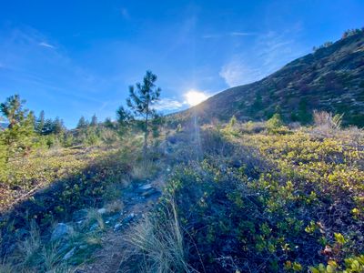
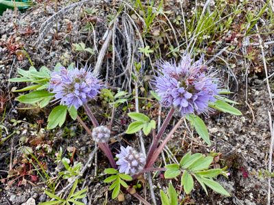
We crossed the dam and started our way up the trail. There were quite a few wildflowers in bloom, with Arrowleaf Balsamroot, Phlox, Ballhead Waterleaf, Serviceberry, Lupine and Larkspur all spotted within the first 10 minutes.
Ballhead Waterleaf
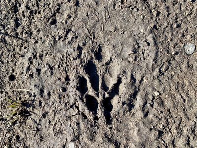
As we headed up towards the ridge, lost in thought, my dog and I pulled ahead of my son. I didn't realize it until a large group of women passed us on the way down, and I pulled over to wait for him. The pack was definitely slowing him down, and he was a bit out of breath when he caught up. I slowed the pace, especially on the steeper parts of the trail.
Once on the ridge, we veered off the main trail to the overlook, found a place to have a seat and had water and snacks. A group of four with two dogs passed us by on their way up, and my puppy, who was off-leash, ran over to them to play with their dogs, ignoring my calls to stop. I had to put him on the leash for the rest of the hike, as he thinks everybody is his best friend and wants to play.
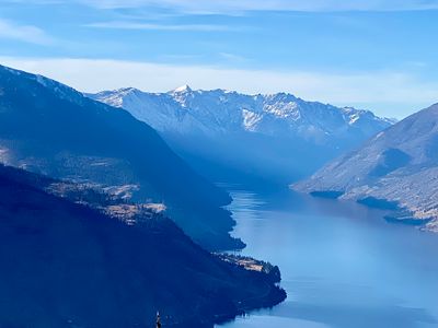
View from the overlook
We slowly made our way up the ridge, Summit and I occasionally having to pull over and wait for my son. It was a beautiful sunny day, and fortunately, it wasn't too hot with a good breeze cooling us down. I enjoyed the views, and the wildflowers, noticing some Sagebrush False Dandelion and Woodland Star in addition to the Arrowleaf Balsamroot and Lupin.
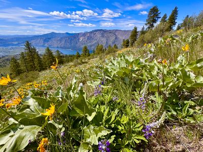
Wildflowers on the way up
Upon reaching the top, we hiked over to the north side and found a spot to sit and enjoy the view - my usual spot, with the downed log to sit on, was occupied by the group that had passed us. There was enough of a breeze that my son put on his jacket as we munched on food.
View of Lake Chelan
The hike down to the car was uneventful, and we didn't encounter anyone else on the trail. It was a successful test run for my son and the backpack, and hopefully we will get out on the Lakeshore Trail soon!
Comments
on this trip report · Apr 2026
More From The Area
Nearby Trip Reports
beExploring / Lake Chelan
Comments
0No comments yet. Be the first to share your thoughts!