Click on an item on the map to view information about it
beExploring · Trip Reports · Ireland · Corofin
Burren Nature Trail
The Burren National Park Nature Trail is the easiest and most accessible walk in the park, making it perfect for a relaxed stroll or a first introduction to the Burren’s unique landscape. This easy loop trail has very…
Plan This Trip
At a Glance
straighten
Distance
1 mile, loop
trending_up
Elevation Gain
60 ft
landscape
High Point
175 ft
backpack
Activity
Hike
Photo Highlights · June 2025
Jump to Trip Report →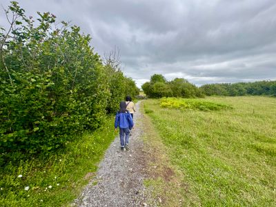
Plan This Trip
Why Go
The Burren National Park Nature Trail is the easiest and most accessible walk in the park, making it perfect for a relaxed stroll or a first introduction to the Burren’s unique landscape. This easy loop trail has very little elevation gain and is well marked and simple to follow throughout. The route winds mostly through open fields of classic Burren limestone, with a short, pleasant section of forest adding a bit of variety, and offers views of Mullaghmore Mountain rising in the distance. It's a low-effort walk with big scenery, ideal for all ages and ability levels.The trail starts just west of Gortlecka Crossroads on Knockaunroe Road and proceeds through a pasture for a couple hundred yards, before crossing over Poulnalour Road, at which point the the loop begins.
Plan This Trip
Route & Map
Plan This Trip
Getting There
directions_car
Directions
If coming from the east or west, drive on Knockaunroe Road to Gortlecka Crossroads, which is the intersection with Poulnalour Road.
local_parking
Parking
There's not a well designated parking lot, however there is room on the side of a couple of the roads at Gortlecka Crossroads to park a car.
edit_note
Field Notes · Personal Trip Report
Quick Burren Respite
We ducked off the Cliffs of Moher drive to Athlone for a limestone-field ramble that reset us before another long car day.
calendar_today June 25, 2025
straighten 1.1 miles, loop · 85 ft gain
chat 0 comments
After spending the morning at the Cliffs of Moher, we decided to stop off for a quick hike in Burren National Park on the way to Athlone, where we were spending the night before continuing onto Dublin. There looked to be a couple of nice moderate hikes up Mullaghmore Mountain, but we were short on time and my wife and son were more interested in a nice stroll, versus a hike. So we opted to do the Nature Trail in Burren National Park, which provided a nice respite from sitting in the car.
We arrived at Gortlecka Crossroads and found a place to pull off on the side of the road. I got mixed up in the direction to the trailhead and we ended up walking a little ways north on Poulnalour Road before I realized my mistake, and we backtracked and found the trailhead. All the trails in the area leave from the same trailhead, and we followed the trail through an open pasture. After a couple of hundred yards, you cross the road and begin the loop. Interestingly, it looks like the trails to Mullaghmore Mountain just follow the road for a ways from this point, before the trail actually begins. When we were driving out, there looked to be a couple places to pull over in the road much closer to where the trails start to head up to Mullaghmore Mountain. If I were to do those hikes, I would drive on Poulnalour Road and find a place to park near where the trail actually begins.
Start of the trail
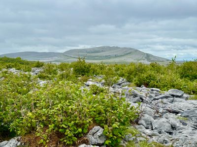
The nature trail continued along through some meadows bordering the forest, and fairly quickly we passed next to some forest before passing through a short section in the forest. We came out of the forest and passed by the Burrent limestone, which had a very cool look and texture to it. In the distance we could see Mullaghmore Mountain, and walked up onto a rise in the limestone to admire the views and take some photos.
Mullaghmore Mountain
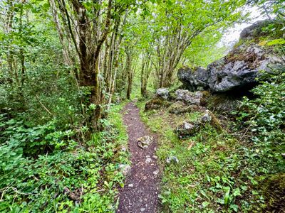
We continued along the trail, and eventually it descended a bit into the forest. It reminded me a bit of the forests in western Washington State that I hiked for so many years before moving to the drier central part of Washington State. True to form, it was overcast, and while it felt like it might rain at any moment, we were spared the precipitation.
Forested section of the Nature Trail
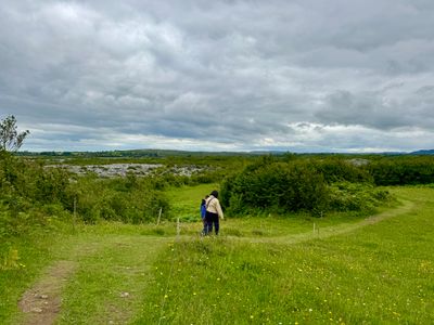
We passed through some more limestone and forest, before the trail turned south and we proceeded through a meadow. It was easy hiking, although there were some rocky sections of the trail around the limestone. It's certainly a trail suitable for kids, as there is next to no elevation gain and it's a little less than a mile.
Open section of the trail
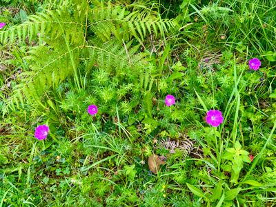
There were various flowers in bloom along the hike, mostly in the meadows but also on the border of the forest.
Flowers along the trail
The loop dropped us back onto the road, a short distance from where it began, and we ended up walking along the road back to the car. I certainly would have preferred to do a longer hike up Mullaghmore Mountain, but this quick loop was a nice break from driving and given the energy levels and time of day, made the most sense for us.
Comments
on this trip report · Jun 2025

Comments
0No comments yet. Be the first to share your thoughts!