Click on an item on the map to view information about it
beExploring · Trip Reports · Oregon · Bend
Deschutes River Trail
The Deschutes River Trail parallels the Deschutes River through the heart of Bend and once fully completed, will extend 19 miles Tumalo State Park to Meadow Camp with further connections to Sun River. The trail passes…
Plan This Trip
At a Glance
straighten
Distance
19 miles
trending_up
Elevation Gain
200 ft
landscape
High Point
3,660 ft
backpack
Activity
Hike
Photo Highlights · April 2024
Jump to Trip Report →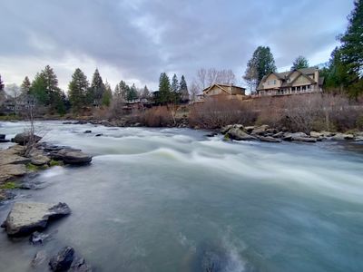
Plan This Trip
Why Go
The Deschutes River Trail parallels the Deschutes River through the heart of Bend and once fully completed, will extend 19 miles Tumalo State Park to Meadow Camp with further connections to Sun River. The trail passes through a number of reaches ( a smaller section of a stream of river which exhibits similar characteristics), including Awbrey, River Run, Pioneer, Old Mill, and South Canyon. There are a number of spots to access the trail throughout Bend, and certain sections of the trail are yet to be completed and require connecting via streets and sidewalks.
Placeholder in dev for ad
Plan This Trip
Route & Map
Plan This Trip
Getting There
directions_car
Directions
Access the trail from one of the parks or places where the trail intersects with streets.
local_parking
Parking
There is parking available at the various parks the trail passes through, including Sawyer Park, First Street Rapids Park, Pioneer Park and Riverbend Park.
edit_note
Field Notes · Personal Trip Report
Mellow River Walk
After a big day at Crater Lake, we took a breezy 4.4-mile stroll along the Deschutes, crossing into First Street Rapids Park and discovering the gravel sections that make this trail feel like your own local escape.
calendar_today April 3, 2024
straighten 4.4 miles, roundtrip · 256 ft gain
chat 0 comments
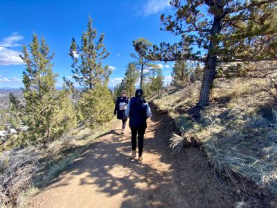
After a nice hike up to Crater Lake along the Raven Trail the previous day, we opted to have a mellow day in Bend and I decided to take advantage of the last of the nice weather and get out for a quick walk along the Deschutes River Trail, which happened to conveniently be just across the street from our hotel.
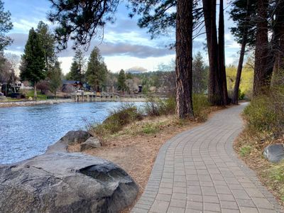
Deschutes River Trail through Pioneer Park
After walking through Pioneer Park, I was on the trail and heading north. My son and I had walked a short section of the trail a couple of days prior, but we got off the trail just after the bridge crosses over the river and into Frist Street Rapids Park, and I was looking forward to continuing along the trail further.
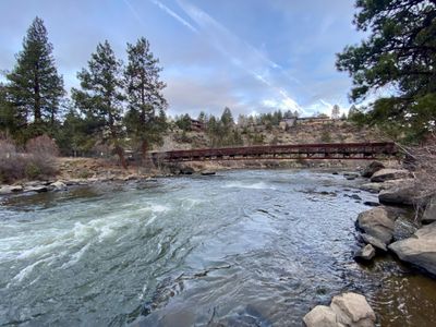
Bridge across Deschutes River
After crossing the river, the trail turned to gravel and paralleled the river for a while. It is a pretty section of the river, with lots of vegetation along the riverbank and pine trees on the opposite shore hiding the houses on the bluff. There were a decent number of folks out jogging, as well as what seemed a small number of people taking work calls while walking on the trail.
Deschutes River
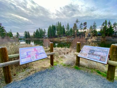
Just before passing by Riverview Park, I took a short break to read a couple of interesting interpretive signs talking about the local fish and vegetation and stream health. The trail then diverged from the river and proceeded through a housing development and along a golf course.
Interpretive Sign
Just before passing by Riverview Park, I took a short break to read a couple of interesting interpretive signs talking about the local fish and vegetation and stream health. The trail then diverged from the river and climbed up a hill before merging onto a sidewalk. The signage was easy to follow and I picked the trail back up a short distance later and proceeded through a housing development and along a golf course.
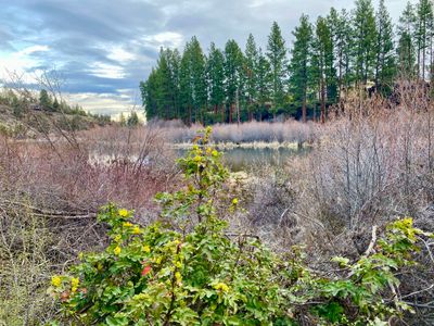
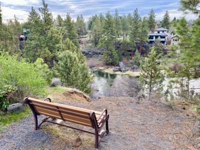
I consulted Google Maps to see if it made sense continuing further. While there was nothing wrong with this section of the trail, it wasn't as scenic as the prior section. However, a short while later the trail emerged from the housing development and golf course and resumed paralleling the river at a higher elevation. Shortly after passing a bench overlooking the river, I decided to turn around.
Overlooking the Deschutes River
I retraced my steps for the walk back, enjoying the views in the other direction. It's pretty awesome to have a scenic trail run right through the heart of a city. Sounds like they are still completing spots, but it's a nice walk and definitely worth doing, especially if you happen to be staying near the trail.
Comments
on this trip report · Apr 2024
More From The Area
Comments
0No comments yet. Be the first to share your thoughts!