
Marion Lake
Wenatchee,
Washington
Overview
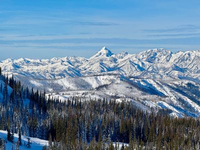
The scree filled slopes above Marion Lake, just outside the Mission Ridge Ski Area boundary, makes for an excellent moderate ski tour around Wenatchee. The approach, roughly 1.5 miles, follows the summer hiking trail and is typically well packed from both backcountry skiers and snowshoers. While the runs are on the shorter side, never exceeding 1,000 ft of elevation, there is a variety of eastern and somewhat northerly slopes to explore. From the Lake Clara Trailhead, follow the trail up to Marion Lake and then proceed southwest to reach the open slopes above the lake. Skin up towards the trees above and pick a run to descend, and then rinse and repeat. You can exit via the approach, or short skin south will position you for a ski traverse over into Mission Ridge for a ski down.
Directions
Parking
Trip Reports
Due to commitments, I had missed some good days up on highway 20 before its winter closure, and I was desperate to get out for my first ski tour of the season. While lift skiing with the family at Mission Ridge, I had ventured off piste a little with my brother and while the coverage was sparse it seemed like enough to warrant a ski tour in the area.
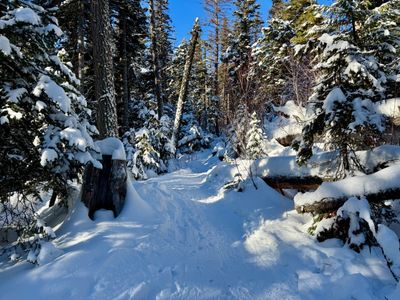
I pulled into the parking lot in the late morning, threw on my gear and proceeded to skin up the Lake Clara summer trail. It was well packed down, and while I could see some ski tracks coming down, I think the majority of traffic was snowshoers and people hiking up sans snowshoes. It was a fairly easy skin up, but I was not looking forward to the ski back down this section.
I passed one couple on the way up and we had a quick chat - they were hiking up and the gentleman mentioned he was waiting for a little more snow before a tour, which in hindsight, was probably the right call. But sometimes one just needs to get out, snow conditions be damned.
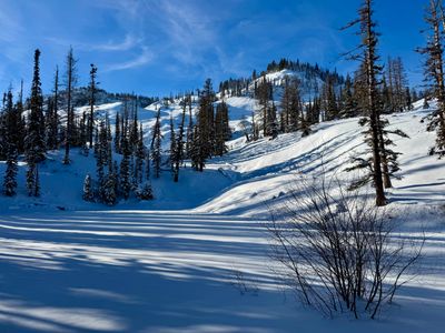
Upon reaching Marion Lake, I had a nice view of the open bowl above, the snow sparkling with the winter sun. My hopes were up, it looked like there might be some decent turns to be had. At the very least, it was a beautiful clear day and it felt great to be out in the mountains.
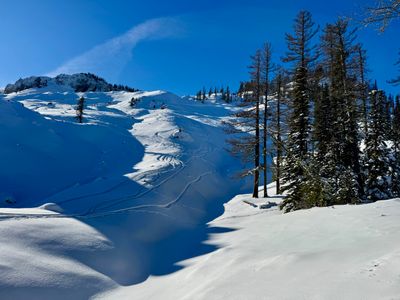
There were a couple of skins up, and I chose the one that headed to the looker's right. I had only been up here one time before with Adam the previous year, and I thought maybe the right skin track would head directly west into new terrain for me. That wasn't the case, as the track contoured around the side of the mountain and went up the main bowl.
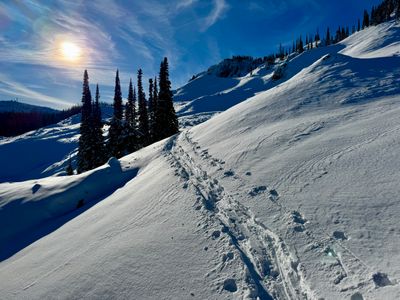
Skinning up, I could see some tracks coming down, and it looked pretty good. There was definitely a good amount of rocks on the slope, but there looked to be some continuous sections of snow that would have good turns. As I came up near the top, the track kept plowing forward and I decided to follow it, thinking maybe it was headed to Mission Peak, which I have never checked out. I made my way through some relatively thick forest, and then it opened up again, and I could see a short slope above me with a couple of tracks coming down.
I kept on the skin track as it wound its way up the hill, and eventually reached a bench. Checking the map, I wasn't that far from Mission Peak, so I kept going and eventually lost the track. At this point, it didn't look worthwhile trying to get to Mission Peak, as it was very rocky, and would probably require some downclimbing. I decided to save Mission Peak for another day and skin back to the top of the slope, admiring the views of Stuart.

I retraced my steps, transitioned to ski mode, and made some cautious turns down the slope. I only hit a single rock, but never felt confident to really open it up, and made my way down slowly.
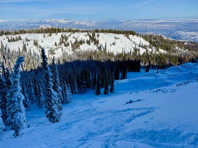
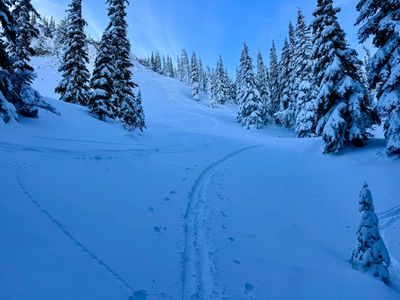
The slope mellowed out, and I followed my skin, opting to head skiers right when the skin track entered the forest. This was a good choice, as I was able to contour around the side of the mountain, avoiding the up and down of the forest for the most part, and eventually ended up in a relatively open area where I could continue skiing down. However, on this slope I hit quite a few rocks lurking below the surface. No core shots, but I was definitely glad I brought my old skis, as the base took some hits on the run down.
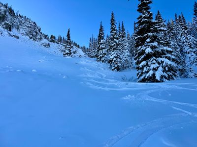
I followed some tracks down the rest of the slope, and it was more of the same. A couple of nice turns, followed by hitting a rock or two. Unfortunately, there just wasn't enough snow to really get a good ski in, although I don't have any regrets, as it was a beautiful day to get out.
For the exit, I thought about skinning over to Mission Ridge to descend, but that area of the mountain was still closed, I wasn't sure how rocky it would be and ultimately decided against it. The exit wasn't too bad. There was a bit of up and down, and the last half required a mix of snow plow, sudden speed checks and off piste log jumping in spots. But I made it safely down to the car, and am anxiously waiting for more snow before I head out around Mission Ridge again.