
Powder Cache
Mazama,
Washington
Overview
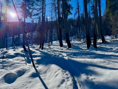
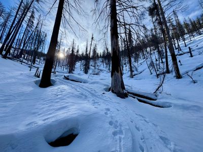
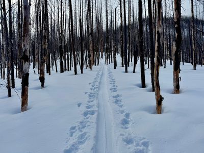
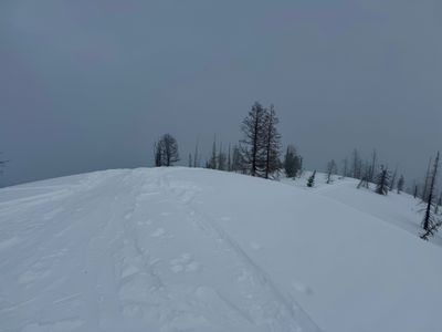
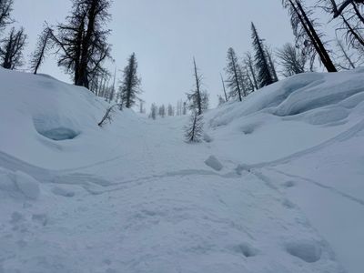
Just west of Varden Creek, the slopes above Highway 20, which I believe locals refer to as the Powder Cache, provide great terrain for storm skiing. The north facing slopes consist predominately of forest with old burn, although you will find some open areas below the western ridge. While there are some steeper sections, the terrain is generally more mild than other nearby areas. From the pull-off, head up and trend lookers left towards the mellow ridge above Varden Creek. Gain the ridge around 5,400 feet and follow the ridge up to the high point of 6.986 feet. From the top, there are various options, with most choosing to head down slightly before the prominent western ridge. While you can ski on the ridge, it can be a bit wind effected and there will likely be some cornices on your right. Eventually you will come into an open area below the ridge, which conditions allowing, can make for some great turns. From there pick your way down through the burn area, heading to the looker's left if you want to exit near your car.
Directions
Parking
Trip Reports
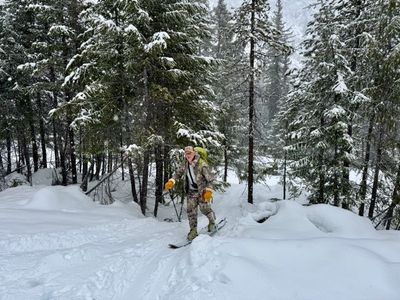
The snow had been slowly piling up in the North Cascades, and I decided to head back to the powder cache with Tim to hopefully get some good powder turns. Tim drove up the night before in his camper and took his dogs out for a quick tour before I got there. He said there was a decent amount of snow on the first 500 feet, so hopes were high that the skiing would be good farther up.
There were four other cars at the pull-off and a group of two started heading up as we were getting ready. We followed suit 10 minutes later and started skinning up the well worn track. There indeed did seem to be a decent amount of additional snow since I had been here on Tuesday.
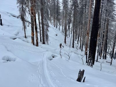
It started to lightly snow on us part of the way up, and the snow continued for the rest of the tour. Once on the ridge we stopped again for more food and hydration and agreed to continue up to the top. There was a good amount of new snow on top of the crust, but fortunately no sign of any wind effect and after doing some quick hand pits on the way up, I was feeling good about the conditions.
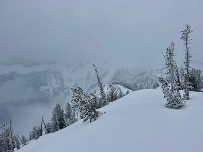
We arrived at the top, and unlike my outing before, we could actually see a little down into Varden Creek and the lower aspects of Silver Star Mountain. We did a relatively quick transition and decided to ski directly down on the ridge.
Unlike last time, where I quickly got off the ridge, Tim and I followed it down for a ways. The skiing was pretty good, but I found the light to be pretty flat and had a hard time seeing the changes in the terrain. While the powder didn't have any wind effect, there seemed to be undulations in the lower layers of snow below the crust, and the drops and rises threw me off a bit. There were also a couple of existing tracks on the ridge, and when crossing them I was occasionally hitting the crust.
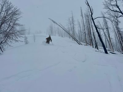
We decided to drop off the ridge to the skier's right, and found a place where there were no cornices to drop in. There were no other tracks in sight and we enjoyed some great powder through the trees.
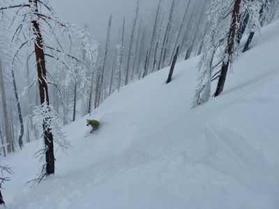
We found some nice alleys through the trees and continued skiing down, favoring skier's left when in doubt.
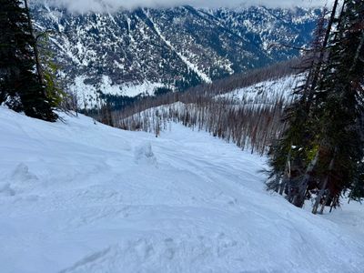
Eventually we spotted the open bowl to our left and made a short traverse over to get into it. There was still a lot of avalanche debris in the bowl, and not enough new snow to cover it, so we stuck to skier's right and found some untouched snow amongst the ski tracks.
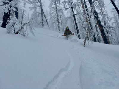
We continued skiing down, stopping only to take some photos and videos. Towards the bottom we stayed skier's left and found some well spaced trees with enough new snow over the crust to make the skiing enjoyable.
We skied to the bottom, found the skin track and then popped out of the forest at the pull-off. A couple of cars had left and one or two new ones had arrived while we were on our tour, but hadn't run into anyone on the tour. Not a bad powder Sunday in an otherwise terrible winter...
With some unexpected free time on my hands during the week, I decided to take advantage and get out for a ski tour on a Tuesday. While there hadn't been a big dump of snow recently, it looked like snow had been accumulating in the North Cascades over the last week, especially at higher elevations. I decided to check out a new area, which I believe the locals refer to as the Powder Cache.
After dropping my son off at school, I arrived at the pull-out around 10:30am and was somewhat surprised to not see any cars in the lot. I had consulted the map the night before to plan out my approach and potential ski, but truth be told, I was hoping there would be a skin track in place and indeed there was a skin track heading up across the road.
I hopped on the skin track and started heading up. There was a dusting of fresh snow on the skin track, and only a couple of inches of powder on top of a solid crust, but I was hopeful there would be more powder up higher. Considering the terrible winter we were having, the coverage was actually pretty good. Probably a solid 3 to 4 feet of snow on the ground, with more up higher.
I hopped on the skin track and started heading up. There was a dusting of fresh snow on the skin track, and only a couple of inches of powder on top of a solid crust, but I was hopeful there would be more powder up higher. Considering the terrible winter we were having, the coverage was actually pretty good. Probably a solid 3 to 4 feet of snow on the ground, with more up higher.
Slowly but surely, the quantity of powder increased as I progressed up the skin track, and by the time I reached the ridge, around 5,400ft, it was clear I would be getting in some decent powder turns today. While the clouds had moved in and completely covered the blue sky from the morning, the ski conditions were looking better and better.
After cruising up the ridge a bit, I started to get really hungry. I had been lost in my thoughts and hadn't been paying much attention to how much vertical I had covered, nor had much further I had to go. Checking my watch, I realized I had gone up 2,600 feet, so I pulled off the skin track and grabbed some food and water. Hydrated and with a full belly, I continued skinning up the mellow ridge, eventually reaching the high point of 6986 ft. Unfortunately, visibility was very limited, and I couldn't see Silver Star or down in Varden Creek Basin.
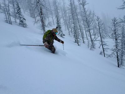
After some more food and water, I transitioned to ski mode and decided to head directly down from where I was. I had some nice turns off the top, and then cut over a bit to get off the ridge and into a gully. The skiing was good in the undisturbed snow, however there were a number of ski tracks through the gully, and I was feeling the crust when going through older tracks.
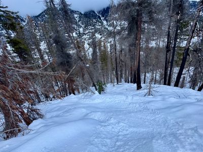
I kept skiing down and then headed skier's left and found a nice alley through the burnt out forest which hadn't been touched. The powder was still deep enough to make for some great turns.

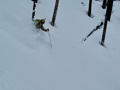
I then spied an open area to my left and made a short traverse over into the bowl. Unfortunately, I could see a lot of older frozen avy debris in the heart of the bowl, but the skier's right hand side was relatively clean. That also meant there were some older tracks going through as well, however there was enough room to enjoy some untouched snow on the way down.
Once I was out of the open area and into the burnt out forest, it was more survival skiing. It wasn't too bad, I've certainly had much worse. There was a thick crust underneath and I had dusted off my big ass powder boards which I hadn't used in at least 5 years, and it took a little getting used to maneuver through the trees on the crust.
At the bottom as I was traversing back towards the car, I saw the road below and decided to exit onto the road and walk back to the car, which was a couple of hundred yards back up the road. It was a better than expected day. Found some nice protected north facing terrain that should hold snow well, and it was a peaceful and relaxing day out in the mountains, with not another soul in sight.