Click on an item on the map to view information about it
beExploring · Trip Reports · Washington · Mazama
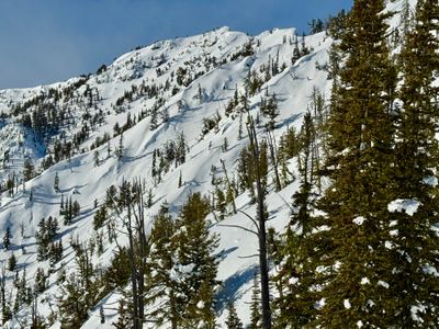
Powder Cache
Just west of Varden Creek, the slopes above Highway 20, which I believe locals refer to as the Powder Cache, provide great terrain for storm skiing. The north facing slopes consist predominately of forest with old bur…
Plan This Trip
At a Glance
straighten
Distance
5 miles
trending_up
Elevation Gain
4,000 ft
landscape
High Point
6,986 ft
backpack
Activity
Ski tour
Photo Highlights · February 2026
Jump to Trip Report →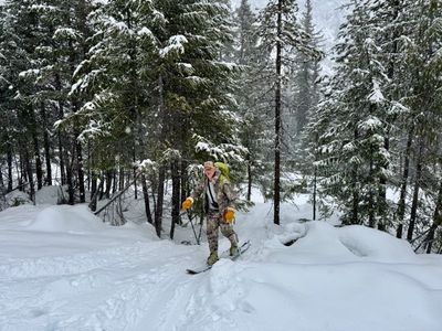
Plan This Trip
Why Go
Just west of Varden Creek, the slopes above Highway 20, which I believe locals refer to as the Powder Cache, provide great terrain for storm skiing. The north facing slopes consist predominately of forest with old burn, although you will find some open areas below the western ridge. While there are some steeper sections, the terrain is generally more mild than other nearby areas. From the pull-off, head up and trend lookers left towards the mellow ridge above Varden Creek. Gain the ridge around 5,400 feet and follow the ridge up to the high point of 6.986 feet. From the top, there are various options, with most choosing to head down slightly before the prominent western ridge. While you can ski on the ridge, it can be a bit wind effected and there will likely be some cornices on your right. Eventually you will come into an open area below the ridge, which conditions allowing, can make for some great turns. From there pick your way down through the burn area, heading to the looker's left if you want to exit near your car.
Placeholder in dev for ad
Plan This Trip
Route & Map
Plan This Trip
Getting There
directions_car
Directions
From Winthrop, head west on Highway 20 for roughly 22 miles. A little past Varden Creek look for the pullout on the right, about a mile before the Silver Star Sno-Park.
local_parking
Parking
There is a good sized pull-off on the right hand side across from the ski tour a mile or so past Varden Creek, and no parking passes are required at this pull-off. Note, accessing this parking lot requires Highway 20 to be open up to Silver Star Sno-Park.
edit_note
Field Notes · Personal Trip Report
2
Trip Reports
I've hiked Powder Cache twice — pick a visit to read its full report.
Fresh Powder Patrol
Tim and I skinned through incoming snow hoping to cash in on the week's accumulation, joining a quiet morning crowd that shared our faith in the Powder Cache's storm-skiing reputation.
calendar_today February 22, 2026
straighten 5.2 miles · 4,543 ft gain
chat 0 comments
The snow had been slowly piling up in the North Cascades, and I decided to head back to the powder cache with Tim to hopefully get some good powder turns. Tim drove up the night before in his camper and took his dogs out for a quick tour before I got there. He said there was a decent amount of snow on the first 500 feet, so hopes were high that the skiing would be good farther up.
There were four other cars at the pull-off and a group of two started heading up as we were getting ready. We followed suit 10 minutes later and started skinning up the well worn track. There indeed did seem to be a decent amount of additional snow since I had been here on Tuesday.
Start of the tour
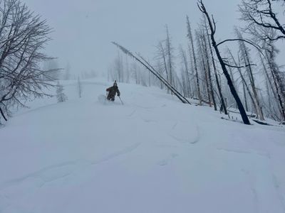
Tim coming up the skin track
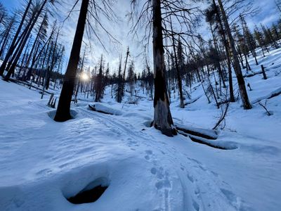
It started to lightly snow on us part of the way up, and the snow continued for the rest of the tour. Once on the ridge we stopped again for more food and hydration and agreed to continue up to the top. There was a good amount of new snow on top of the crust, but fortunately no sign of any wind effect and after doing some quick hand pits on the way up, I was feeling good about the conditions.
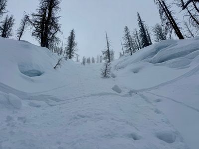
We arrived at the top, and unlike my outing before, we could actually see a little down into Varden Creek and the lower aspects of Silver Star Mountain. We did a relatively quick transition and decided to ski directly down on the ridge.
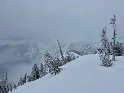
Views from the top
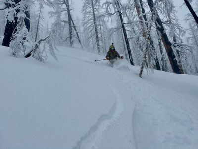
Unlike last time, where I quickly got off the ridge, Tim and I followed it down for a ways. The skiing was pretty good, but I found the light to be pretty flat and had a hard time seeing the changes in the terrain. While the powder didn't have any wind effect, there seemed to be undulations in the lower layers of snow below the crust, and the drops and rises threw me off a bit. There were also a couple of existing tracks on the ridge, and when crossing them I was occasionally hitting the crust.
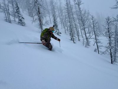
Tim coming down the top
We decided to drop off the ridge to the skier's right, and found a place where there were no cornices to drop in. There were no other tracks in sight and we enjoyed some great powder through the trees.
Tim skiing off the ridge
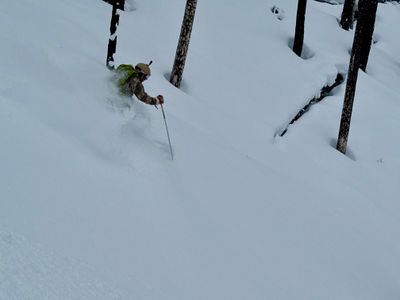
We found some nice alleys through the trees and continued skiing down, favoring skier's left when in doubt.
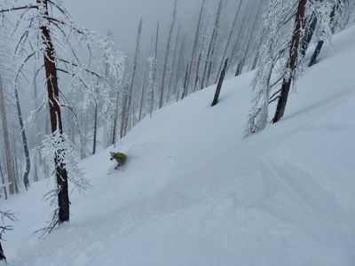
Nice pow
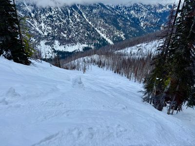
Eventually we spotted the open bowl to our left and made a short traverse over to get into it. There was still a lot of avalanche debris in the bowl, and not enough new snow to cover it, so we stuck to skier's right and found some untouched snow amongst the ski tracks.
Tim enjoying the snow
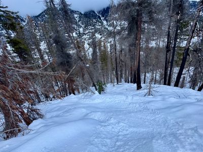
We continued skiing down, stopping only to take some photos and videos. Towards the bottom we stayed skier's left and found some well spaced trees with enough new snow over the crust to make the skiing enjoyable.
Tim near the bottom
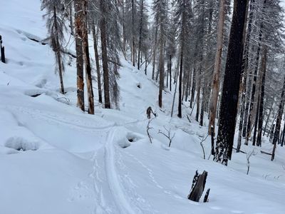
We skied to the bottom, found the skin track and then popped out of the forest at the pull-off. A couple of cars had left and one or two new ones had arrived while we were on our tour, but hadn't run into anyone on the tour. Not a bad powder Sunday in an otherwise terrible winter...
Comments
on this trip report · Feb 2026
More From The Area
Comments
0No comments yet. Be the first to share your thoughts!