Click on an item on the map to view information about it
beExploring · Trip Reports · Washington · North Bend
Snoqualmie Valley Trail
One of the few long-distance flat trails in the Cascade foothills, the Snoqualmie Valley Trail lets you cover serious mileage through beautiful river valley scenery without any significant climbing. Whether you want a…
Plan This Trip
At a Glance
straighten
Distance
31.5
trending_up
Elevation Gain
620 ft
landscape
High Point
440 ft
backpack
Activity
Hike
Best For
multi-usebikedog-friendlyfamily-friendlyflatrail-trailPhoto Highlights · June 2026
Jump to Trip Report →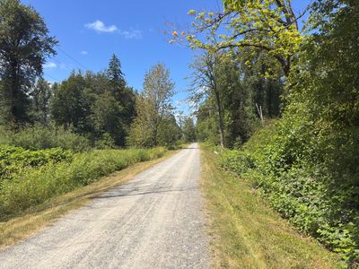
Plan This Trip
Why Go
The Snoqualmie Valley Trail is a 31.5-mile multi-use trail running through the scenic Snoqualmie Valley, from Rattlesnake Lake near North Bend north to Duvall. Built on a former railroad grade, the trail is nearly flat and follows the Snoqualmie River corridor, passing through farmland, river bottomlands, forest, and small towns. It's one of the longest flat trails in the greater Seattle area and is popular with cyclists, runners, walkers, and families with kids.
Placeholder in dev for ad
Plan This Trip
Route & Map
Plan This Trip
Getting There
directions_car
Directions
The Snoqualmie Valley Trail has multiple access points spread across its 31-mile route, so your directions will depend on where you plan to start. Common access points include the Rattlesnake Lake Recreation Area off Cedar Falls Road SE near North Bend (southern terminus), the Fall City trailhead off SE 43rd Street, and the Duvall trailhead on NE Big Rock Road (northern terminus). Search for your intended access point by name for turn-by-turn directions.
local_parking
Parking
There are multiple access points along the trail's 31-mile length, so parking will depend on where you plan to get on the trail. Trailhead parking is available at the Rattlesnake Lake Recreation Area near North Bend (south end), in downtown North Bend, near Tollgate Farm, in Fall City, and at the Duvall trailhead (north end), among other points.
edit_note
Field Notes · Personal Trip Report
A Quick Walk on the Snoqualmie Valley Trail
A leisurely dog-friendly stroll near North Bend before lunch at South Fork
calendar_today June 20, 2026
straighten 1.1 miles, roundtrip · 10 ft gain
chat 0 comments
The day after attending the US versus Australia world cup game, it was time to wrap up our short trip to Seattle and head back home. We were planning on stopping by South Fork for lunch in North Bend, and we wanted to walk the dog and get a little exercise prior to lunch. I was originally thinking we may hike up Little Si, but decided for something more leisurely and landed on the Snoqualmie Valley Trail.
I have ridden on the trail a number of years ago when we did a bike ride from Snoqualmie Pass down to the Red Hook Brewery in Woodinville, but this was my first time walking on the path. We parked on a residential street nearby and walked over to the trail.
Start of the hike
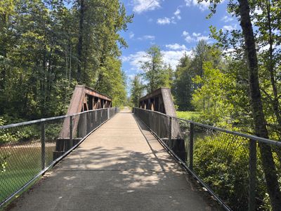
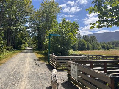
There was a steady stream of bikers coming by, good to see people out enjoying the trail. Once across the bridge we passed Tollgate farm trail, which my dog Summit tried to walk down.
Tollgate Farm trail
About a half mile in, we decided to turn around. We had left Seattle later than expected, and with it already past 1pm, we were all very hungry and looking forward to heading to South Fork for a late lunch.
Bridge along the trail
Comments
on this trip report · Jun 2026
More From The Area
Comments
0No comments yet. Be the first to share your thoughts!