Click on an item on the map to view information about it
beExploring · Trip Reports · Washington · Seattle
Union Bay Natural Area
While Union Bay Natural Area doesn’t seem very big, measuring in at 74 acres, it’s the second largest natural system on Lake Washington. The Waterfront trail is a short loop that will take you by a couple of ponds and…
Plan This Trip
At a Glance
straighten
Distance
1.2 miles loop
trending_up
Elevation Gain
20 ft
landscape
High Point
15 ft
backpack
Activity
Hike
Photo Highlights · November 2021
Jump to Trip Report →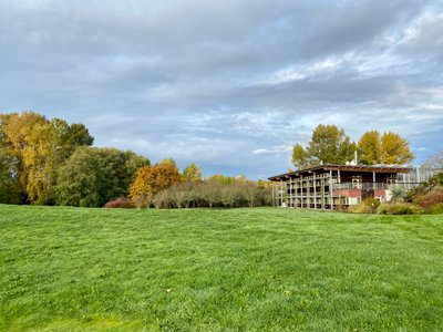
Plan This Trip
Why Go
While Union Bay Natural Area doesn’t seem very big, measuring in at 74 acres, it’s the second largest natural system on Lake Washington. The Waterfront trail is a short loop that will take you by a couple of ponds and also provide sweeping views of Lake Washington. This area is very popular with birders, as you can expect to see numerous kinds of waterfowl and birds. The waterfront trail can be combined with the Yesler Swamp trail, which has a number of raised platforms to take you through the bog.
Placeholder in dev for ad
Plan This Trip
Route & Map
Plan This Trip
Getting There
directions_car
Directions
Driving north on I-5, take exit 168B for WA-520 toward Bellevue/Kirkland. Once on 520, take the first exit toward Montlake Blvd/Univ Of Washington. Turn left onto Montlake Blvd E. Continue onto NE 45th St and then turn right onto Mary Gates Memorial Dr NE. Turn right onto NE Clark Rd and and the parking lot at The Center for Urban Horticulture will be on your left.
local_parking
Parking
There is parking available at the The Center for Urban Horticulture
edit_note
Field Notes · Personal Trip Report
Herons & Hidden Parking
I discovered free parking near the gardens and spotted a Blue Heron at Carp Pond while looping the Waterfront Trail counterclockwise through lush forest into open grassland.
calendar_today November 3, 2021
straighten 1.6 miles loop · 40 ft gain
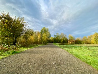
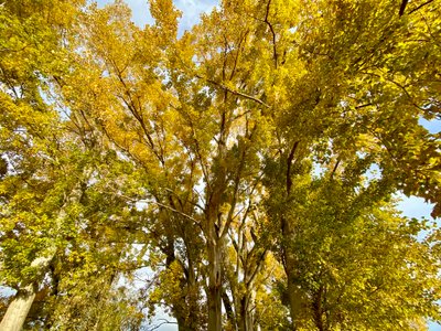
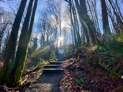
I was unsure where I was going to park prior to coming, but found a free parking lot with tons of empty spaces right near the Soest Herbaceous Display Garden. I took a dirt road which looped behind the Center for Urban Horticulture, and hooked up with NE Wahkiakum Lane, which was a nice wide open gravel road that took me past a typically lush Northwest forest and then into a more open country with grass and smaller trees.
Lawn behind the Center for Urban Horticulture
Forest along NE Wahkiakum Lane
NE Wahkiakum Lane
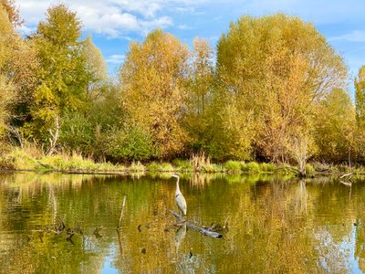
At the first junction with the Waterfront Trail, I decided to continue on NE Wahkiakum Lane and take the Waterfront Trail loop counterclockwise - no particular reason behind the decision, it’s safe to assume either direction will give you great views of Lake Washington, as well as the ponds. As I walked around Carp Pond, I noticed some ducks as well as a Blue Heron, and I was able to walk up to the edge of Carp Pond and snap a photo of the Blue Heron. Afterwards, I noticed that many of the people walking this loop had either binoculars and or DSLR cameras with huge lenses - this is obviously a good spot to watch birds.
Blue Heron in Carp Pond
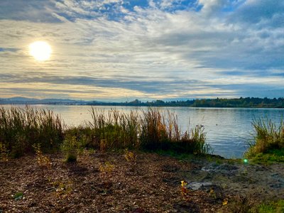
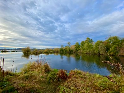
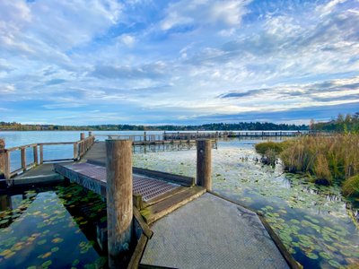
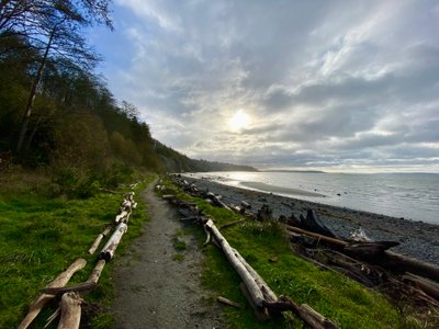
I continued along the Waterfront trail, and noticed a side trail headed up to Central Pond had a number of people on it, so opted to continue along the Waterfront. A lot of the area near the water had fencing around it, and the signs indicated they were trying to rehabilitate the area. There were still a number of places where you could get close to the water and get great views of Lake Washington. And every time I got the near the water I saw ducks or geese or some other bird.
View of Lake Washington
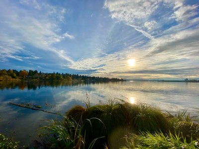
Lake Washington from the Waterfront Trail
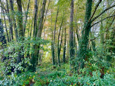
Tree canopy off of Waterfront Trail
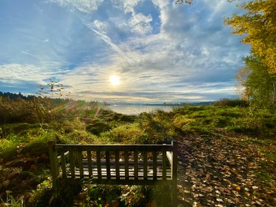
Bench overlooking Lake Washington
I sat on a bench of a second to take in views of the lake, and then continued along the loop before getting back on NE Wahkiakum Lane. I decided to head towards the buildings and walk around front of the Center for Urban Horticulture, which took me through the Soest Herbaceous Display Garden - it was interesting to see how they had segmented the plants by the the type of soil and amount of sun they like to receive. As I neared the car, I noticed there was another trail through the Yesler Swamp, which I had never heard of. It looked like a quick hike, so I went for it.
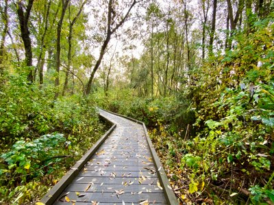
Raised platform through Yesler Swamp
The Yesler Swamp trail mostly consists of a raised wooden platform which takes you through the swamp, which is thick with trees. It’s a nice contrast to the Waterfront Trail, and halfway through the loop it opens up and you can see Lake Washington. All along the trail are a number of signs providing information about the area. I was glad I opted to take the short hike through the swamp.
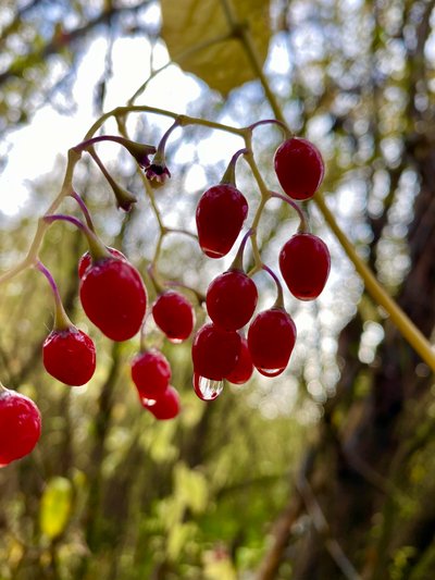
Berry with morning dew in Yesler Swamp
View of Lake Washington from Yesler Swamp
While it's a short hike, even throwing in the Yesler Swamp loop, it's beatiful and defintely worth it, especially if you get to see a Great Heron!
Comments
on this trip report · Nov 2021
More From The Area
Nearby Trip Reports
beExploring / Seattle
Comments
0No comments yet. Be the first to share your thoughts!