Entiat
Things to Do
in Entiat
Hiking, waterfalls, water sports, fall foliage, and snowmobiling in the Cascade Mountains.
Entiat Overview →beExploring / Entiat
Overview
Entiat punches well above its size for outdoor recreation. The valley extends over 30 miles into the Okanogan-Wenatchee National Forest, with activities spread across all four seasons — hiking and waterfall chasing in spring and summer, spectacular fall color in October, and snowmobiling above the snowline in winter.
Most people know Entiat as a pass-through on Highway 97A between Wenatchee and Lake Chelan. That's a mistake. Silver Falls alone is worth the stop, and the rest of the valley rewards a full day or weekend of exploration.
beExploring / Entiat
Best Things to Do at a Glance
Best overall experience
Silver Falls in the morning — 1.7 miles to a 141-foot waterfall you can walk behind — then the upper-valley drive to Entiat Falls and Box Canyon
Best for first-time visitors
Silver Falls, then an afternoon at the Entiat City Park beach on the Columbia with Cascade views across the water
Best in fall
Mad River Road in mid-October when the Bigleaf Maples peak — the best fall color in central Washington with almost no one else on the road
Best for families
The flat first three miles of the Mad River Trail from Pine Flat Campground, then swimming at Entiat City Park
Best in winter
Snowmobiling from the Entiat Sno-Park up toward Shady Pass, where the snowpack holds above 6,000 feet after the rest of the region thaws
The valley's best trails
Hiking
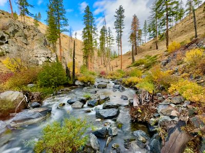
The Entiat Valley has trails for every level — from easy riverside walks to strenuous high-elevation routes with panoramic Cascade views. Most trailheads are deep in the valley, so budget extra drive time. Silver Falls is the most popular trail; the Mad River and backcountry routes reward those willing to go farther.
Silver Falls Trail
A 1.7-mile round trip through old-growth Douglas fir to a 141-foot waterfall you can walk behind. The most accessible hike in the valley and a strong choice for families. Best in spring when flow is strongest. See the Silver Falls trip report for current conditions.
Mad River Trail
Follows the Mad River through pine and cedar forest for over 14 miles into the backcountry. The first 3 miles from Pine Flat Campground are flat and excellent for families. Hikers can turn around anywhere — the trail just keeps going. Also a popular mountain biking route.
Angle Peak & Devils Backbone
Two strenuous high-elevation routes with panoramic views across the Entiat and Chelan Valleys. Both are long, remote, and best done in late summer or fall after the snow clears. Larches add spectacular color in October. See the full hiking guide for details.
Fire Lookouts
Tyee Mountain and Steliko lookouts are both available for overnight rental through Recreation.gov. The hikes to either are strenuous, but the summit views across the valley are exceptional. Tyee is open June through October; Steliko is accessible year-round. See the Steliko Lookout guide for details.
Cascades and canyon views
Waterfalls
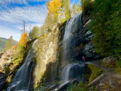
The Entiat Valley has some of the most accessible waterfall scenery in central Washington. Silver Falls is the highlight — a short trail to a 141-foot drop you can stand behind. Farther up the valley, Entiat Falls is one of Washington's most accessible waterfalls, reached directly from the road with no hiking required. Box Canyon adds canyon drama to the same upper-valley drive.
Silver Falls
A 141-foot waterfall at the end of a 1.7-mile round trip hike through old-growth forest. The most impressive viewpoint puts you directly behind the falls — a rare experience. Spring snowmelt produces the strongest flow, but the falls run year-round when the access road is clear. A Northwest Forest Pass or $5 daily fee is required to park.
Entiat Falls
One of the most accessible waterfalls in Washington — Entiat Falls drops over a series of volcanic rock ledges into a narrow gorge, and you can see it from a roadside pullout on Entiat River Road with no hiking required. The falls are located about 36 miles from the town of Entiat, just past the North Fork Campground turnoff. Park at the wide spot on the road and walk to the edge of the gorge. The falls run strongest in spring and early summer when snowmelt swells the Entiat River; by late summer the flow is more modest but still scenic. Entiat Falls pairs naturally with Box Canyon Viewpoint — both are in the same stretch of upper valley and neither requires a long hike. Allow at least 90 minutes each way from town on a narrow mountain road, and check road conditions before heading up.
Box Canyon Viewpoint
A steep-walled canyon carved by the Entiat River through ancient volcanic rock, with views of Fish Trail waterfall dropping into the gorge below. Located well up the valley, Box Canyon is quiet and uncrowded. Worth pairing with Entiat Falls on a drive to the upper valley.
Lake Entiat & the Columbia River
Water Activities
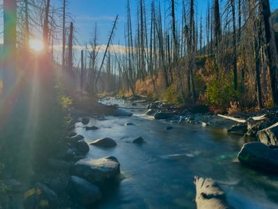
Lake Entiat — the Columbia River reservoir formed by Rocky Reach Dam — offers calm, warm water for boating, kayaking, and paddleboarding from early summer through early fall. Entiat City Park has a boat launch and beach with views of the Cascade Mountains. The Entiat and Columbia Rivers are also productive fishing destinations.
Boating & Paddleboarding
Lake Entiat's mild currents make it ideal for leisure boating, tubing, and paddleboarding. The Entiat City Park boat launch is the main access point — it includes parking, beach areas, and picnic space. From the water you can see bald eagles, ospreys, and the vineyard-covered hillsides above town.
Fishing
The Entiat River is a productive trout and steelhead fishery, with Chinook salmon runs in fall. Farther downstream where the Entiat joins the Columbia, bass, walleye, and additional salmon species add more options. Small lakes and streams in the upper valley hold smaller trout and are good for a quiet day of fishing.
Swimming
The beach at Entiat City Park offers a calm, accessible swim area on the Columbia with a sandy shoreline and views upriver. The river can run fast in early summer with snowmelt — conditions are best from July onward.
September and October
Fall Foliage
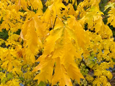
Entiat Valley is one of central Washington's best fall foliage destinations, and it stays relatively uncrowded compared to more famous areas. The Bigleaf Maples along Mad River Road are the main draw — peak color typically hits mid-October. Higher up the mountains, larches turn gold at elevation, though reaching the best stands requires a long hike.
Mad River Road Maples
The Mad River Road, off Entiat River Road, passes through exceptional Bigleaf Maple forest. October brings vibrant gold and orange color to the canopy, visible from the road. The short walk along the Mad River trail here is an easy way to get into the trees. Peak color varies but typically falls in the second or third week of October.
Larches at Elevation
Western larches — the only deciduous conifer in the Cascades — turn brilliant gold in late September and early October. The best stands in the Entiat Valley are at higher elevations and require long, strenuous hikes. Conditions vary year to year depending on snowpack and timing. Check recent trip reports before committing to a larch hike.
Entiat Valley Scenic Drive
The 30-mile drive up Entiat River Road itself is a highlight in fall. Cottonwoods and aspens line the river, the hillsides above town show changing color, and the deep valley gets quieter the farther you go. Plan for an early start — the narrow road means turnaround times add up.
November through March
Snowmobiling
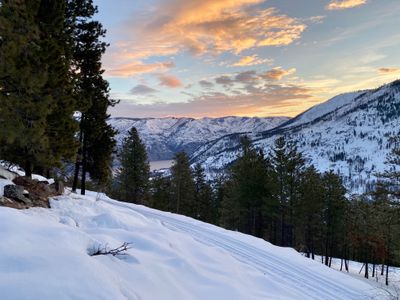
The Entiat Valley mountains are one of the best snowmobiling areas in central Washington. Elevations above 4,000 feet provide reliable deep snowpack from December through March. The Tyee Mountain and Shady Pass areas offer groomed trails alongside open backcountry terrain, with ridge views across the Entiat Valley to Lake Chelan.
Entiat Sno-Park
The Entiat Sno-Park is the primary staging area for snowmobilers heading up the valley. A valid Sno-Park permit is required from November 1 through March 31 — pick one up at outdoor retailers or online before you go.
Tyee Mountain Area
The routes around Tyee Mountain include groomed trails, open alpine meadows, and ridgeline terrain with views across the Entiat and Chelan valleys. Suitable for a range of skill levels, from groomed trail cruising to technical backcountry riding.
Shady Pass
Shady Pass offers the most advanced terrain in the area — wide-open play areas, steep climbs, and ridgeline routes that reach elevations over 6,000 feet. Strong snowpack and consistent conditions when the rest of the region thaws out. Best for experienced riders.
Summer and fall
Mountain Biking & Dirt Biking
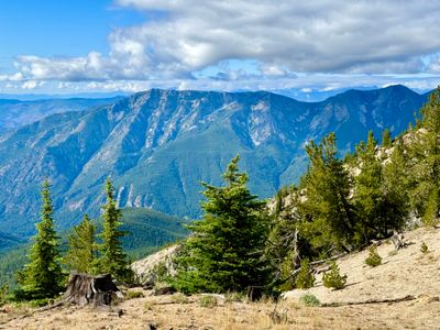
The Entiat Mountains have a strong off-road riding scene that stays under the radar. The Mad River and Tyee Ridge networks offer technical singletrack, open ridgelines, and big elevation changes. Dirt bikers will find a separate set of routes through the Tommy Creek and Devil's Backbone areas — looser terrain with dramatic views.
Mad River Trail
A popular route for both mountain bikers and hikers, the Mad River Trail follows the river through forest and meadows with varied terrain. Moderate difficulty with options to extend into more challenging sections. Also accessible as an out-and-back from the lower trailhead.
Tyee Ridge
A high-elevation network with steep climbs, fast descents through wildflower meadows, and long singletrack sections. The views from the ridge extend over the Entiat Valley. Technical in places — better suited to intermediate and advanced riders.
Tommy Creek & Devil's Backbone (Dirt Biking)
The Tommy Creek area and Devil's Backbone trail are the main dirt biking routes — tight switchbacks, rocky technical sections, and hill climbs through pine forest and open alpine terrain. The Devil's Backbone sits on a high ridge with views of both the Entiat and Chelan valleys.
beExploring / Entiat
Planning Tips
Entiat Valley Road runs over 30 miles. Trailheads and campgrounds deep in the valley are a long, winding drive from town — build in extra time and check your fuel before heading up.
Summer temperatures in the valley regularly exceed 90°F. Plan morning starts for hiking and bring more water than you think you need.
Reserve Silver Falls parking and upper valley campgrounds in advance for summer weekends. They fill up faster than most people expect for a remote area.
Check current fire restrictions before any trip involving campfires or off-road vehicles. The Entiat Valley sees regular closures in dry years.
beExploring / Entiat
Common Mistakes
Driving past Entiat without stopping. The valley looks like a quick side road from Highway 97A — it's actually one of the best outdoor destinations between Wenatchee and Lake Chelan.
Skipping Silver Falls because it sounds too short. At 1.7 miles round trip, it's one of the best waterfall hikes in the region. The falls are genuinely impressive.
Not checking road and trail conditions before visiting in shoulder season. Snow can linger into June on upper valley roads and trails, and early fall weather can turn quickly.
Missing fall foliage timing. The Mad River Road maples peak in mid-October and it's over fast — check recent reports before making the drive specifically for fall color.
beExploring / Entiat