Click on an item on the map to view information about it
beExploring · Trip Reports · Washington · Manson
Goff Ridge
Goff Peak has a ridge extending to the west that is easily accessible which offers some north facing slopes with decent elevation and a nice pitch. However, most of the northern slopes are covered in thick vegetation …
Plan This Trip
At a Glance
straighten
Distance
7.8 miles, roundtrip
trending_up
Elevation Gain
2,500 ft
landscape
High Point
4,330 ft
backpack
Activity
Ski tour
Photo Highlights · January 2025
Jump to Trip Report →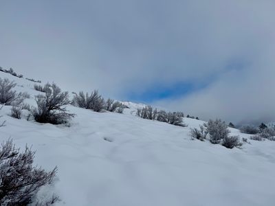
Plan This Trip
Why Go
Goff Peak has a ridge extending to the west that is easily accessible which offers some north facing slopes with decent elevation and a nice pitch. However, most of the northern slopes are covered in thick vegetation and a smattering of rock features limiting ski terrain. But with the right amount of snow coverage, there are lines to ski. I have my eye on a couple, however I have only skied one to date, so this trip report focuses on that particular area.
From the Antilon Sno-Park skin up groomed snowmobile trail along Grade Creek Road, and near camping Site C, begin ascending the slope, keeping to the looker's left of the small ravine above the campsite. Follow this slope up to the high point on the ridge. From here, it looks like the best option is to head along the ridge for roughly 100 yards and then descend favoring your skier's right - this should keep you clear of the heavy vegetation down low. If you descend directly down from the high spot (this is the route I have skied) , the upper slopes are reasonably open - at a couple points you may need to traverse a small amount to find another open swath - but a little over half way down you will have to cut skier's right through thick vegetation to get to an open area. On both descents you will eventually be funnelled into a small rocky ravine, which with enough coverage is skiable. However, from this point you may want to consider skinning back up to the ridge and skiing the southern slope you ascended, as the rest of the ski is not memorable and it's a fairly long exit via the groomed snowmobile trail.
From the Antilon Sno-Park skin up groomed snowmobile trail along Grade Creek Road, and near camping Site C, begin ascending the slope, keeping to the looker's left of the small ravine above the campsite. Follow this slope up to the high point on the ridge. From here, it looks like the best option is to head along the ridge for roughly 100 yards and then descend favoring your skier's right - this should keep you clear of the heavy vegetation down low. If you descend directly down from the high spot (this is the route I have skied) , the upper slopes are reasonably open - at a couple points you may need to traverse a small amount to find another open swath - but a little over half way down you will have to cut skier's right through thick vegetation to get to an open area. On both descents you will eventually be funnelled into a small rocky ravine, which with enough coverage is skiable. However, from this point you may want to consider skinning back up to the ridge and skiing the southern slope you ascended, as the rest of the ski is not memorable and it's a fairly long exit via the groomed snowmobile trail.
Placeholder in dev for ad
Plan This Trip
Route & Map
Plan This Trip
Getting There
directions_car
Directions
Drive on WA-150/W Manson Rd towards Manson, and turn right on Wapato Point Road for 2.3 miles. Turn right onto Upper Joe Creek Road and after 2.2 miles continue on Grade Creek Road. In the winter, the road will end at The Antilon Lake Sno-Park, with a parking lot to the left of the road.
local_parking
Parking
Park at the Antilon Lake Sno-Park at the winter closure point on Lower Grade Creek Road. The Antilon Sno-Park requires a pass roughly late November through April or as posted (depending on snow, Sno-Park may open later / close earlier). If closed, just park on the side of the road near the gate to Grade Creek Road.
edit_note
Field Notes · Personal Trip Report
West Ridge Reconnaissance
I followed last week's skin track too eagerly up Grade Creek, then discovered scattered skiable lines threading through the vegetation on Goff's western aspect.
calendar_today January 29, 2025
straighten 7.8 miles, roundtrip · 2,500 ft gain
chat 0 comments
After a quick but fun ski off of the south ridge of Goff a week earlier, I decided to mosey on up to Antilon Lake and take a look at the ridge running west off of Goff Peak. It looked like a longer descent and studying the satellite images lead me to believe there may be some skiable lines.
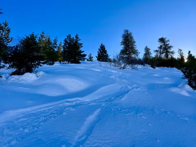
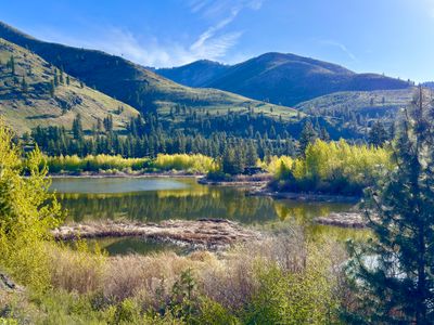
The forecast was calling for a clear day, but there were low hanging clouds completely blanketing the sky. I've noticed over the last couple of years that if you can get above the cloud layer in the Chelan Valley, you will find the forecasted blue sky and was hoping that was the case today. I followed Grade Creek road and hopped into my skin track from a week earlier. Lost in the moment, I followed the skin track a bit too long and had to find a suitable place to cross over the small ravine and get on the slope that heads up to the ridge I had in mind. I started to see some blue sky as I skinned up the slope, confirming my suspicion that there were low hanging clouds from the lake with blue sky above.
Blue sky in my future
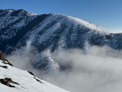
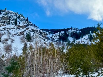
Around 3,600 feet I was above the cloud layer, with bluebird skies above me. I'm assuming the cold air temperatures, especially overnight, interact with relatively warm lake water and cause this cloud layer, as it is only around the lake and is very low elevation. I was able to get a view of the south goff ridge lines I skied earlier in the week - nothing too impressive, but it's a nice short tour and typically holds powder during cold dry spells, so it's a nice option to have in my backyard.
South Goff Ridge slopes
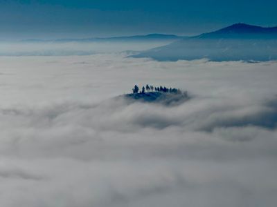
There was also a cool view of the very top of Fourth of July Mountain poking through the clouds - looked like an island amongst the cloud layer. Upon reaching the high point on the ridge, I had to figure out where to descend. I poked around a bit, but wasn't able to discern much from the ridge.
Fourth of July Mountain in the clouds
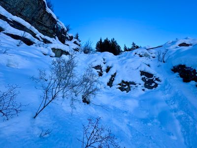
I found a reasonably open spot a little skier's right of the high spot and started to ski down. I figured if it proved unskiable, I would throw the skins back on and try another option. The snow was good, with recycled powder and enough coverage that I wasn't dodging too much underbrush or fallen logs. Every time the vegetation seemed to close in, I could find another opening and continue skiing. It was better than expected!
Turns down the top section
Eventually my luck ran out and the vegetation started to quickly thicken, with no end in sight. Once it became unbearable, I picked my way over skier's right towards an open slope. It was a couple hundred yards, with a little bit of side stepping up the slope to avoid some sections. The open slope appeared to extend up towards the ridge, so I plan to ski this part next time. I laid some more turns down and then was eventually funneled into a rocky section. I was able to pick my way through, and it would have actually been a fun ski if I was more confident about not thrashing on some rocks.
Rocky section
The very bottom wasn't bad, but wasn't particularly fun. There was more and more vegetation and the recycled powder gave way to crusty snow. But I was able to ski down to the bottom without incident, and was quite pleased I was able to find an enjoyable ski down from the ridge on my first attempt.
The bottom part of the run
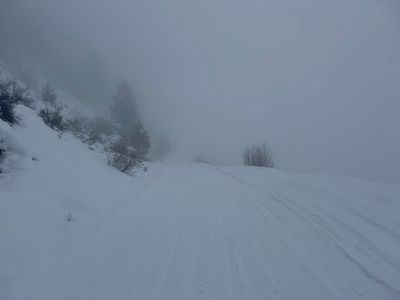
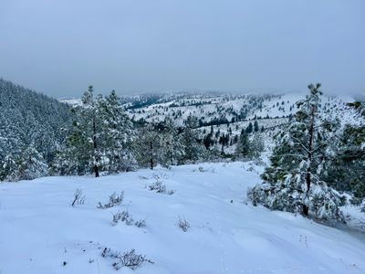
The run ended on a snow covered forest service road, and I skied down to the groomed snowmobile trail along Grade Creek Road. I thought about putting my skins on, but the snow was firm and there was a little bit of downhill that I could take advantage of. Hitting some uphill after a bit, I decided to skate and herringbone rather than put the skins on, as I was hopeful the uphill wouldn't last long (this was my first time this far out on Grade Creek). It was a little longer than expected, but eventually it turned into a downhill and I was able to ski along the frozen snowmobile trail. By this time, I was back in the clouds and it was actually a little difficult flying down the frozen trail with limited visibility - I didn't want to slow down and risk having a lot more uphill.
Back in the clouds
I passed by a small group of Nordic skiers taking a break alongside the trail. I had noticed some old tracks along the side of Grade Creek road on the way in, and couldn't tell if it was nordic or backcountry skiers, but I am guessing it was nordic skiers as I haven't seen any other tracks going up slopes. The exit along Grade Creek was long, but wasn't too bad given the trail was frozen solid and moved fast. It would be somewhat painful if the snow was soft and you had to skin in - in that case, I think I would rather just skin back up the descent to the ridge, and ski the southern slope back down to Grade Creek.
Comments
on this trip report · Jan 2025
More From The Area
Nearby Trip Reports
beExploring / Lake Chelan
Comments
0No comments yet. Be the first to share your thoughts!