Click on an item on the map to view information about it
beExploring · Trip Reports · Washington · Chelan
No Where To Zoom
No Where to Zoom is my name for a west facing aspect within Echo Ridge that has a number of trails crossing the slope, including the Zoom and No Where To Ride trails. From the high point of 3,825 feet just above the U…
Plan This Trip
At a Glance
straighten
Distance
2 miles, roundtrip
trending_up
Elevation Gain
800 ft
landscape
High Point
3,825 ft
backpack
Activity
Ski tour
Photo Highlights · March 2023
Jump to Trip Report →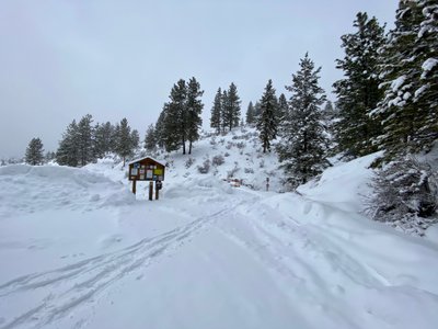
Plan This Trip
Why Go
No Where to Zoom is my name for a west facing aspect within Echo Ridge that has a number of trails crossing the slope, including the Zoom and No Where To Ride trails. From the high point of 3,825 feet just above the Upper Ridge View nordic trail, one can ski a little under 800 vertical feet down to the Zoom trail. The trees are typically fairly well spaced in this area, but like most slopes in Chelan, there is underbrush and the ability to ski this aspect depends on a healthy snowpack depth.Given this run crosses a couple of nordic trails, care should be taken to not disturb the track as you ski down. Or better yet, hit it on the rare powder day before the nordic track has been laid.
Access this area by parking at the Zoom trailhead, and skinning along the Zoom trail until the first large bend in the trail at a drainage, and then proceed up to the high point of 3,825 feet just above the Upper Ridge View nordic trail.
Access this area by parking at the Zoom trailhead, and skinning along the Zoom trail until the first large bend in the trail at a drainage, and then proceed up to the high point of 3,825 feet just above the Upper Ridge View nordic trail.
Placeholder in dev for ad
Plan This Trip
Route & Map
Plan This Trip
Getting There
directions_car
Directions
If there has been snow overnight, consult the grooming report from the Lake Chelan Nordic Club to determine when the road will be plowed.
From Chelan, take WA-150/W Manson Rd for approximately 2 miles. A short ways after the traffic circle, turn right onto Boyd Road. Continue on Cooper Mountain Road and then Cooper Gulch Road and finally onto Echo Ridge Forest Service 8021-100 Rd/NF-8010. The Zoom Trailhead will be on your left about a mile and a half after passing the Echo Valley Ski Area.
From Chelan, take WA-150/W Manson Rd for approximately 2 miles. A short ways after the traffic circle, turn right onto Boyd Road. Continue on Cooper Mountain Road and then Cooper Gulch Road and finally onto Echo Ridge Forest Service 8021-100 Rd/NF-8010. The Zoom Trailhead will be on your left about a mile and a half after passing the Echo Valley Ski Area.
local_parking
Parking
There is a small plowed parking lot at the Zoom trailhead. A $15 day pass per person is required payable at the zoom trailhead (kids 17 and under are free).
edit_note
Field Notes · Personal Trip Report
Late-Season Powder Laps
A rare spring snowstorm delivered fresh powder to the Echo Ridge slopes, and I carved up the west-facing drainage above Zoom trail while one other soul had the same idea.
calendar_today March 10, 2023
straighten 3.3 miles, roundtrip · 2,050 ft gain
chat 0 comments
A late season storm, for the Chelan area at least, meant we had some fresh powder on the surrounding slopes. It had been awhile since I had explore around Echo Ridge, but this offered the perfect option for a few quick powder laps after work. Earlier in the season on a ski tour around Outback, I had noticed the slopes above the Zoom trail looked decent.
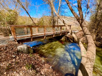
Zoom trailhead
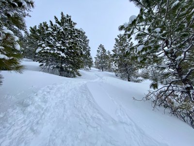
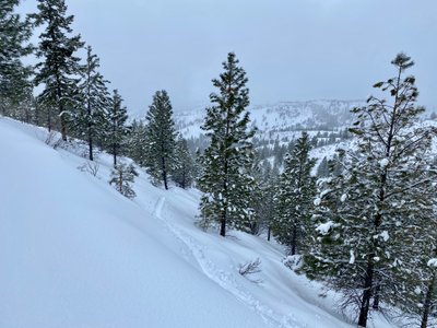
There was one other car in the parking lot, and as I skinned the Zoom trail I could see a couple snowshoeing up ahead. Before I reached the snowshoers, I arrived at the first bend in the trail and started skinning up the drainage. Looking at the map earlier in the day, it looked like I could follow the drainage up a bit, and then start proceeding directly up towards the high point.
Drainage
There was a decent amount of new snow on the ground, probably about a foot. However, it was a little heavier than I was expecting - typical of the snow quality I was used to around Snoqualmie Pass. Breaking trail required a little extra work in the new snow, but went by pretty fast. I made a mental note of a couple of open lines through the trees for my descent.
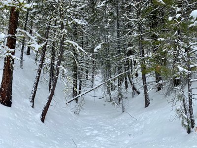
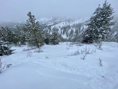
Looking down the run
I crossed a couple of the ungroomed nordic trails and upon reaching the high point I transitioned into ski mode. It was overcast with limited visibility so I wasn't able to scope out any of the surrounding area and see if anything might be of interest for another ski tour. But the viz was good enough to have a fun ski down, finding some open paths through the trees.
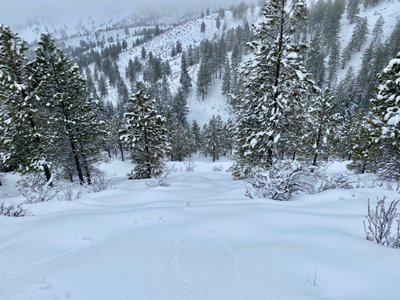
Turns from my first run
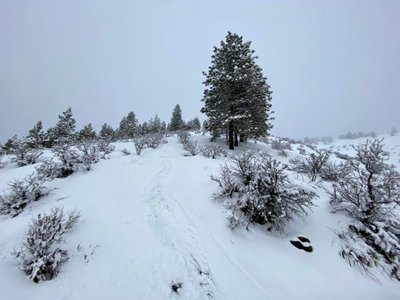
I ended up going skier's right of my skin track, and upon reaching the drainage towards the bottom decided to transition to skin mode, as the rest of the ski down to the Zoom trail was low angle. I quickly found my skin track, and enjoyed a quick skin up without having to break trail.
Skin track up
On my second descent, I figured I would ski more to the left and end up at the Zoom trail, but was pulled to the right again, and ended up near my first run. I decided to head up for one more final run.
Tracks from my second run
At the top for my third run, I did a quick consult of the map, and it looked like I might be able to ski directly down to the trailhead. From the top, I headed skier's left and made sure to stay in that direction as I descended. There weren't many trees on this aspect, resulting in thick underbrush popping up through the snow and part of the way down I headed back to the right.
Turns through the bitterbush
I abandoned the idea of skiing to the trailhead, but found a nice line along the ridge and then ultimately back down to where I had started ascending on the zoom trail. A quick skin back to the car and my day was done. Great to get out for one final ski in the Chelan Valley, with power nonetheless. It was pretty limited vert, but a good place for a quick powder laps close to home.
Comments
on this trip report · Mar 2023
More From The Area
Nearby Trip Reports
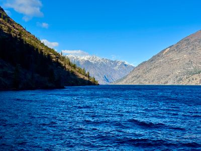
beExploring / Lake Chelan
Comments
0No comments yet. Be the first to share your thoughts!