Click on an item on the map to view information about it
beExploring · Trip Reports · Washington · Chelan
Beebe Springs Wildlife Area
A walk along the Columbia River with beautiful views of the water and surrounding canyon. Choose your distance between half a mile and 3 miles. At low elevation, this trail sheds snow earlier than most options in the …
Plan This Trip
At a Glance
straighten
Distance
.5 to 3 miles
trending_up
Elevation Gain
50 ft
landscape
High Point
930 ft
backpack
Activity
Hike
Best For
WildflowersDogs AllowedRiverDiscover PassKid FriendlyMid-DistancePhoto Highlights · April 2026
Jump to Trip Report →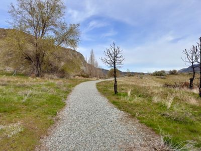
Plan This Trip
Why Go
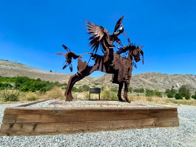
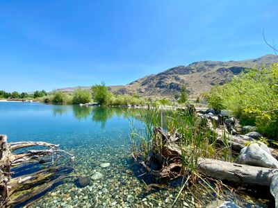
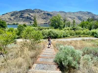
Beebe Springs Wildlife Area is a 200 acre former orchard on the banks of the Columbia River that has undergone extensive rehabilitation to improve salmon and steelhead spawning habitat. There are a number of short, but connected trails throughout the main wildlife area and you will find steel sculptures of Native Americans, interpretive signs and benches interspersed throughout the area. Included is Buddy’s pond, which allows free fishing for anyone under the age of 12. Across Highway 97 is another section of the park located on a hillside with 3 additional trails. Specific information about this area can be found under my Cultus Jim & Chelan Bob trip report.
Plan This Trip
Route & Map
Plan This Trip
Getting There
directions_car
Directions
Driving North on Highway 97 from Wenatchee, the parking lot is on the right a couple hundred feet after crossing over the Columbia River via Beebe Bridge.
To access the upper trailhead parking, driving North on Highway 97 from Wenatchee, take a left onto Highway 150 immediately after Beebe Bridge. Drive 1.6 miles and the parking lot will be on the right hand side.
To access the upper trailhead parking, driving North on Highway 97 from Wenatchee, take a left onto Highway 150 immediately after Beebe Bridge. Drive 1.6 miles and the parking lot will be on the right hand side.
local_parking
Parking
There is a main parking area off of Highway 97 and there is also a small parking lot off of Highway 150 which provides access to the hillside via three trails. A Discover Pass is required at both parking lots.
edit_note
Field Notes · Personal Trip Report
2
Trip Reports
I've hiked Beebe Springs Wildlife Area twice — pick a visit to read its full report.
Easy Miles with Puppy
I brought my dog to Beebe Springs for a low-key 1.75-mile loop while he recovered from back-to-back outdoor days, discovering that early-season wildflowers were sparse compared to nearby Chelan Gorge.
calendar_today April 2, 2026
straighten 1.75 miles, roundtrip · 43 ft gain
chat 0 comments
I wanted to get out for a relatively easy hike with my puppy, as he seemed tired from doggy day care the day before (and we did a decent hike in the Chelan Gorge the day before that), so I decided to head down to Beebe Springs while my Discover Pass was still valid. I was curious to see if there were any wildflowers popping, and while there were a little, it wasn't nearly as much as I had seen in the Chelan Gorge.
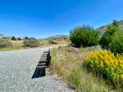
It had been quite awhile since I had hiked in this part of the Beebe Springs Wildlife Area (I have hiked the upper section a couple of times recently), and I decided to head down the Discovery Loop trail, as last time we had walked around the LaChappelle and Grasslands trails. The Discovery Loop trail is a nice wide gravel path and easy going.
Start of the hike
I saw what I thought at first was an arrowleaf balsamroot at the start of the trail, but it looked a little different. I now believe it is actually Carey's balsamroot instead. Surprisingly, I did not see another Carey's balsamroot nor an arrowleaf balsamroot on the rest of the hike.
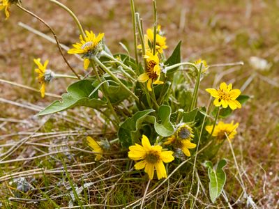
Carey's balsamroot
I continued along the trail, and let my puppy Summit do his usual sniffing. Fairly quickly we came to the junction with the North Spur Trail where there was a worker in a truck spraying water on a small burn area. I saw some other recent burn areas further along in the hike; I'm guessing there was some invasive species they wanted to eradicate and burned the area? Anyways, I continued along the North Spur Trail and eventually found a short side trail down to the riverbank, where my dog could drink some water.
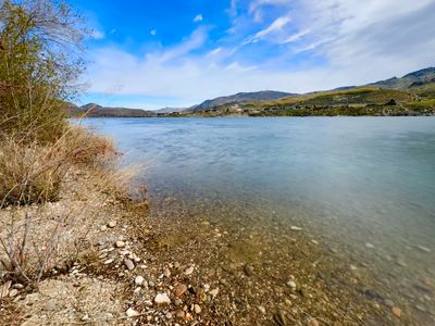
Columbia River
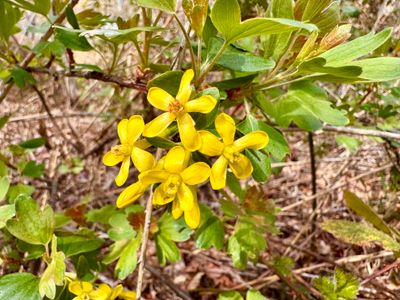
golden currant
I came back on the North Spur trail and continued along the Discovery Loop, finding some Oregon grape along the way that was just starting to flower. I wasn't expecting the flowers to be yellow, so I didn't know what I was looking at until after the hike.
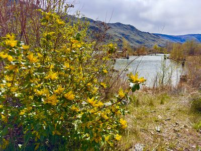
Oregon grape
Eventually I reached the end of the loop back near the parking lot. Checking my watch, I realized I hadn't even reached a mile, so I decided to continue onto the LaChappelle trail. The last time we had been here, a section of this trail was flooded and closed, however that was not the case today. Most of the trail is gravel, however there was a short section of dirt through a marshy area, which was part of the area closed last time.
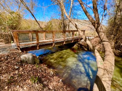
There were a couple of streams draining into the Columbia, with a bridge over one of the larger streams. There was quite a bit of water pooled up on the side of the trail, and I could see something decently sized moving through the water. It was hard to make out what it was, but I'm pretty sure it was a fish. Given the shallow depths, I wasn't expecting to see a fish, especially one of that size.
Bridge on the LaChappelle Trail
Eventually I got onto the Grasslands trail, and made my way back to the car. I was hoping for some more wildflowers on the walk, but it was still nice to get out and get some exercise.
Comments
on this trip report · Apr 2026
More From The Area
Nearby Trip Reports
beExploring / Lake Chelan

Comments
0No comments yet. Be the first to share your thoughts!