Click on an item on the map to view information about it
beExploring · Trip Reports · Washington · Chelan
Box Canyon
The longest lakeside trail in the Chelan area, stretching 4 miles one way to reach the lake. You don't need to hike the full distance. Going just part of the way still makes for a rewarding outing. For those who make …
Plan This Trip
At a Glance
straighten
Distance
13 miles, roundtrip
trending_up
Elevation Gain
1,800 ft
landscape
High Point
2,380 ft
backpack
Activity
Hike
Best For
Lake ViewsWildflowersDogs AllowedNo Pass RequiredLake AccessMid-DistancePhoto Highlights · November 2025
Jump to Trip Report →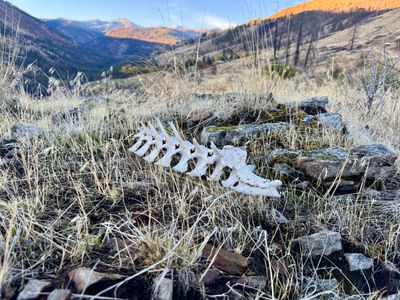

Plan This Trip
Why Go
While other trails like Elephant Head, Chelan Butte and 4th of July Mountain provide scenic views of Lake Chelan, Box Canyon is the only car accessible trail which not only provides lake views, but access to Lake Chelan. The trail was recently completed in 2025 and is hands down one of the best trails in the area. The first section of the trail switchbacks up the side of the mountain through open meadows, and while you will climb roughly 600 feet in the process, the grade of the trail is gentle. The trail then levels off and proceeds into a more forested section, before descending down towards Lake Chelan. At mile 4, there is a side trail down to a campsite and access to the lake. From here on out, the trail follows above the shoreline with a little bit of up and down. At roughly 5.5 miles, there is another side trail down to a campsite and lake access. At 6.5 miles there is a fork in the trail, with the left section deadending in a couple hundred yards. Proceed right to head down to the final campsite and lake access, with a great view uplake. Note, while there are 3 access points to Lake Chelan, these are on rocky shorelines - don't expect a nice sandy beach!
Placeholder in dev for ad
Plan This Trip
Route & Map
Plan This Trip
Getting There
directions_car
Directions
Drive north on South Lake Shore Road for 16.4 miles, and then take a left turn onto Shady Pass Road. In 1.1 miles, turn right onto Breezy Heights road / NF-127. In a couple hundred yards, take the right fork in the road to arrive at the trailhead (note, there is a gate on this road, and it may be closed and locked).
local_parking
Parking
There is a good sized parking lot with ample space. There are no restrooms, and as of now, there is no signage or indication that a forest pass is required. The gate to the parking lot may be closed, in which case you can find parking on the side of the road. The trail begins on the left hand side of Breezy Heights road, where it begins to bend left, above the parking lot area.
edit_note
Field Notes · Personal Trip Report
2
Trip Reports
I've hiked Box Canyon twice — pick a visit to read its full report.
The Full Box Canyon
I finally returned to complete the newly finished trail, discovering the lower section to Lake Chelan was worth the year-long wait since construction blocked my previous attempt.
calendar_today November 2, 2025
straighten 14.5 miles, roundtrip · 3,042 ft gain
chat 2 comments
With the Box Canyon trail being completed recently, it was a perfect time to venture across the lake and check out the rest of the trail. Almost a year ago to the date, I had hiked the first couple of miles of the Box Canyon trail, turning around when I encountered some heavy equipment working on the section of the trail that descends down towards the lake. The gate to the parking lot was locked, and while there is a USFS trailhead wooden kiosk in place in the parking lot, there was no signage or information on the kiosk. There also didn't seem to be a discernible trail from the parking lot up to the start of the trail. I imagine they will probably get the parking lot ready for next spring / summer.
After checking out the parking lot area, I went up to the start of the trail and started hiking up. The day light savings time change allowed me to get an early start, a little after 7:30am, and it was quite cool. Fortunately it was not cool enough to freeze, as the ground was still wet from the rain the day before. The trail is starting to get a bit overgrown, and a frozen layer of grass and mud would have been challenging. Before long, I warmed up and had to shed a layer as I followed the trail as it switchbacked up the mountainside.
Bones on the trail
The trail steadily climbs up the mountainside via a series of switchbacks, but the incline of the trail is pretty moderate, making the roughly 600 feet elevation gain pretty easy. There is still evidence of the heavy machinery brought in to work on the trail, with the old tracks overlapping the trail a couple of times. A little over a mile in, the trail trends north and has nice views downlake of Lake Chelan. If you are looking for a real short hike with some views of the lake, this is certainly an option as a turn around point.
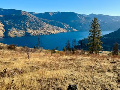
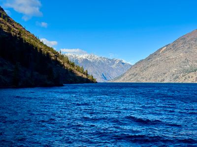
View of Lake Chelan
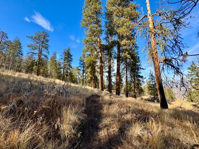
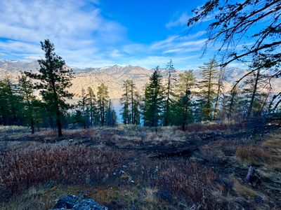
The trail goes relatively flat, and then enters into a more forested area, although like much of the forests around Lake Chelan there is evidence of a burn, I believe from the 25 Mile Creek Fire in 2021. But it didn't decimate the larger trees and you will find some shade in this section of the hike.
Heading into the forest
A little before mile 2, the trail starts to descend towards the lake. The slope quickly steepens as you proceed down, but there are numerous switchbacks on the trailI - I'm guessing around 30 switchbacks before the trail flattens out. You drop about 1,200 vertical feet over the course of 2 miles, and the trail itself is not steep, making it a nice hike down (and not too strenuous on the way back up).
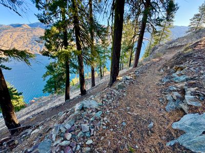
Going down
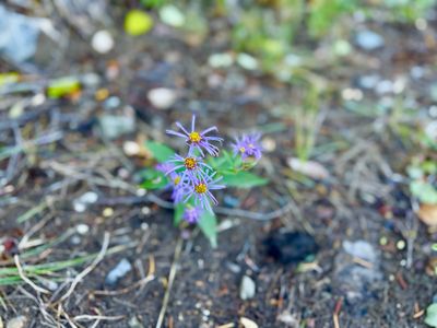
A little past mile 4 after the trail flattened out, I noticed a side trail heading down towards the water line. I know there were a couple of access points to the water, and decided to continue on my way and check out this side trail on the way back. There were a couple of flowers along the trail that I didn't recall seeing around Lake Chelan before, and after the fact learned they were Asters, I think Douglas Aster, which blooms in the late summer and fall.
Douglas Aster
I made good time along this section of the trail, as it is mostly flat, sitting about 100 feet above the lake. There are nice views of the lake, and I could see snow covered Uno Peak off in the distance. A little over a mile in I crossed over a small stream coming down from Grouse Mountain - I imagine in the heart of the summer the stream is dry. Roughly a half mile later I passed the second side trail which heads down to the lake, and again decided I would explore the trail on the way back.
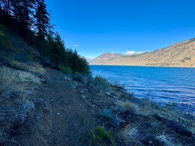
Box canyon trail
As I neared the end of the trail, I encountered a split in the trail. This was surprising, as thought the trail simply ended at the lake. I took the left section and found that it was dead-ended a couple of hundred yards ahead. I'm curious why they put it in this section, are there plans to extend it at some point? I backtracked to the junction and then took the trail on the right as it switchbacked a couple of times down towards the lake. On the side of the trail there was a small area with a stone firepit for a campsite, however, it didn't look particularly level.

Campsite near the end of the trail
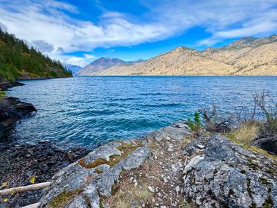
The trail continued a short distance down to the lake, and I found a nice spot on the rocky shoreline to take my first break, and have some water and food. I quickly had to throw on my jacket, as it was very windy and quite cold. During the hike there had been a light breeze, but nothing noticeable, but now on the shoreline the wind was whipping with whitecaps on the water. I enjoyed the views uplake of Pyramid Peak for a bit, then decided to get a move on again and warm back up.
View uplake of Pyramid Peak
Reaching the first side trail, I was unsure if I wanted to head down. I was already 9 miles into the trip, and had quite a way to go back to the car. However, I didn't know when I would be back here, and decided that I would check out this side trail and potentially not bother with the next one if I was too tired. While the trail isn't long, it felt that way as I descended a little over 100 feet down to the lake. There was a nice camping spot above the lake, which was somewhat removed from teh trail and looked more level than the previous one.

View downlake from second side trail
Upon reaching the first side trail, I decided to head on down. No point in not exploring the lake access, and while my feet were starting to get a little sore, I otherwise felt good. This also had a small spot suitable for a campsite, and a couple of different ways down to the water. I opted to go left, and found a nice place to sit for another quick bite before the final push back up the trail. At 8 miles roundtrip, this spot would make a great hike in the summer!
View uplake from first side trail
Having explored all parts of the Box Canyon trail, I made my way backup the roughly 1,200 feet of switchbacks to the car, passing a group of 4 people on the way - the only other folks I saw on the hike. With the cool temps, the climb up the side of the mountain was pretty nice, and before long I was descending back to the car, happy to have explored this new trail. I think this will make an excellent hike in the summer with swimming half way through to cool you off!
Comments
on this trip report · Nov 2025
More From The Area
Nearby Trip Reports
beExploring / Lake Chelan

Comments
0No comments yet. Be the first to share your thoughts!