Click on an item on the map to view information about it
beExploring · Trip Reports · Washington · Chelan
Chelan Butte
The defining hike of downtown Chelan. The butte dominates the skyline and rewards with a panoramic 360-degree view taking in the full length of Lake Chelan, the Columbia River valley, and surrounding mountains. At 2,7…
Plan This Trip
At a Glance
straighten
Distance
7.8 miles, roundtrip
trending_up
Elevation Gain
2,700 ft
landscape
High Point
3,800 ft
backpack
Activity
Hike
Best For
Lake ViewsWildflowersDogs AllowedNo Pass RequiredClose to TownPhoto Highlights · April 2023
Jump to Trip Report →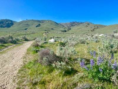
Plan This Trip
Why Go
Chelan Butte hike has a good amount of vertical gain, with a couple sections of moderately steep uphill. But the exertion comes with a benefit - less than one mile into the Chelan Butte hike, you will be treated to scenic views of Lake Chelan, with additional views of the Columbia River coming in the latter half of the hike. Only a couple of minutes outside of Chelan, and wildflowers galore during the spring, this is one of the best hikes in the Chelan Valley. And if the mileage or vertical is a little too much for you, then cut the hike short and turn around at Elephant Head. Note, there is virtually no shade on this hike, so bring plenty of water and sunscreen.
From the trailhead, cross Gorge road and proceed up the trail. Look for a sign on your right about 10 minutes into the hike, which will have you cross a small gully and onto another dirt road. Follow this road until you see a sign on your left for Elephant Head and Chelan Butte trail. The trail will switchback a couple of times as it heads up the mountain, at which point it will cross over the gully and traverse around the mountain. At roughly two miles, take the side trail to Elephant Head, or proceed another two miles and 1,500ft up to the top of Chelan Butte.
From the trailhead, cross Gorge road and proceed up the trail. Look for a sign on your right about 10 minutes into the hike, which will have you cross a small gully and onto another dirt road. Follow this road until you see a sign on your left for Elephant Head and Chelan Butte trail. The trail will switchback a couple of times as it heads up the mountain, at which point it will cross over the gully and traverse around the mountain. At roughly two miles, take the side trail to Elephant Head, or proceed another two miles and 1,500ft up to the top of Chelan Butte.
Placeholder in dev for ad
Plan This Trip
Route & Map
Plan This Trip
Getting There
directions_car
Directions
From Chelan, take the Sanders Street Bridge across the river and take your first left on E Farnham Ave, which turns into Saunders St. Turn left onto E Iowa St, and you will see the parking lot on your left in .2 miles.
local_parking
Parking
There is a decent sized paved parking lot at the Chelan Butte trailhead with a porta-potty bathroom, and finding a parking spot is usually not an issue. No permits are fees are required to park at the Chelan Butte Trailhead.
edit_note
Field Notes · Personal Trip Report
Wildflowers In Peak Bloom
I finally tackled the full Chelan Butte hike in spring and found myself surrounded by fields of Arrowleaf Balsamroot and Alpine Lupine, surrounded by more fellow hikers than I'd ever seen on the nearby trails.
calendar_today April 28, 2023
straighten 7.8 miles, roundtrip · 2,700 ft gain
chat 0 comments
I had hiked up to Elephant Head two years ago, ski toured on Chelan Butte this winter, but had yet to do the Chelan Butte hike. With Arrowleaf Balsamroot on full display everywhere around Lake Chelan, it was time to head to the Butte and enjoy some wildflowers. There were a good number of people at the trailhead, more than I have seen any previous times while hiking around Reach One. I guess I wasn't the only one interested in seeing fields of wildflowers and enjoying the warm temps.
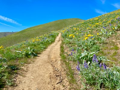
The start of the trail had plentiful wildflowers, with Arrowleaf Balsamroot and Alpine Lupine blanketing both sides of the trail, with occasional patches of shooting stars and other wildflowers I am not familiar with. Within the first twenty minutes, I had taken way too many photos of the wildflowers and decided I needed to be more selective about stopping for wildflower photos...
Wildflowers at the start of the hike
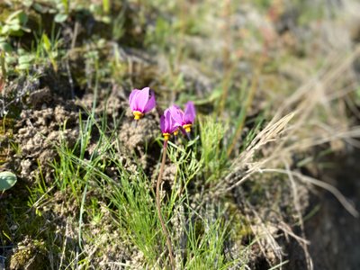
Shooting star wildflower on Chelan Butte Hike
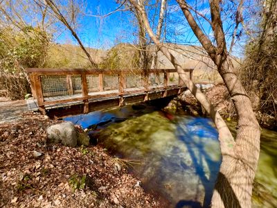
I crossed over the gully and passed by another hiker heading up the road. Speaking of the road, it looked like it had been recently re-graded. I had heard on the local radio station about concerns of development on Chelan Butte and wondered if this could be related. Looking after my hike, I don't see any mention of actual development happening as of yet. But you can see on the Chelan Conservancy Basin website that potential development would be right where I was hiking through and would certainly impact this hike.
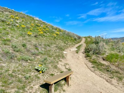
I came to the first switchback on the hike and passed by a bench - I remembered seeing one bench when I hiked Elephant Head two years ago, but it seemed like there were more now. I wonder if they were recent additions or I didn't notice them the last time? This bench was directly in the sun, but a couple of the other benches up the trail were strategically located in the shade, or at least they were in the shade when I passed them (and there are very few places on this hike that have shade).
First bench on the hike
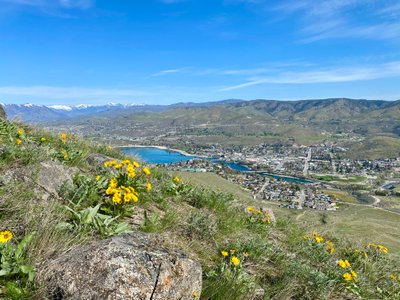
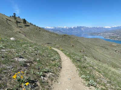
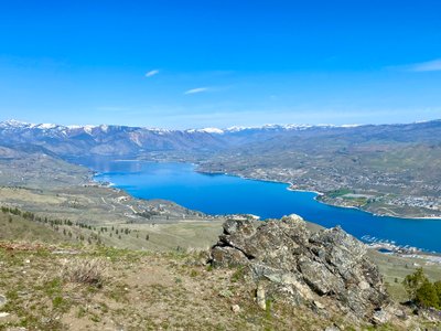
I passed by a couple other folks coming down the trail and caught the first views of Lake Chelan on the hike. I was happy to reach the part of the trail that starts traversing over to Elephant Head, as it provided a nice respite from the steady incline. It was still relatively early in the day, but was heating up quickly.
Wildflowers and Lake Chelan
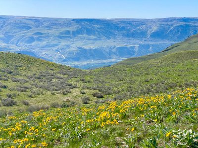
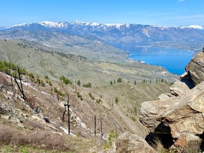
Past the turnoff for Elephant Head, the trail steepened for a while, before mellowing out along the ridge. There were a ton of Arrowleaf Balsamroot flowers on the southern slope, along with views of the Columbia River. I passed by a couple more folks heading down, and crossed paths with an older gentleman from Montana who had just reached the trail after hiking directly up the hillside, which was pretty steep!
Columbia River below Chelan Butte Trail
More wildflowers on the Chelan Butte Trail
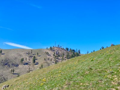
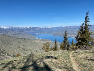
Hiking along the ridge provided for more views of both Lake Chelan and the Columbia River. The top of Chelan Butte, very noticeable off in the distance with the cell phone towers, still seemed to be quite far away. There was another steep section of the trail, which really got the heart rate going and made me think twice about trying to make it to the top without taking a break.
Top of Chelan Butte
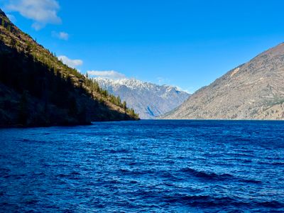
Lake Chelan
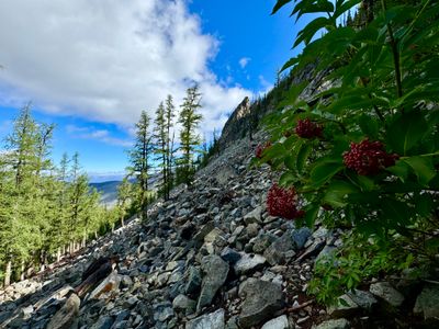
The trail mellowed out again providing some time to catch my breath before the final push to the top. The wildflowers were quite in bloom yet at this elevation, which wasn't surprising considering it had been covered in snow a couple weeks prior. I could even see some remnants of snow on shaded areas of the mountain.
A little snow left on Chelan Butte
I took a quick break at the top to hydrate and eat a little food, and then it was time to head back down. It would have been nice to have some trekking poles to handle the downhill. This was my first hike of the year, and my legs weren't entirely prepared for 2,500ft of downhill. I passed by a number of people coming up the trail, continued to admire the wildflowers and views and made it to the car, with a total time of roughly three hours.
View from the top of Chelan Butte
Heading down the Chelan Butte trail
Great springtime hike with wildflowers galore, and not to mention a very convenient location. Probably won't be doing this hike in the summer, but it is a good one to get the heart rate going and will be back soon.
Comments
on this trip report · Apr 2023
More From The Area
Nearby Trip Reports
beExploring / Lake Chelan
Comments
0No comments yet. Be the first to share your thoughts!