Beebe Springs Hatchery Trailhead
748 ft
No restrooms Fee required 1 hike
Trails: Toad Creek Trail
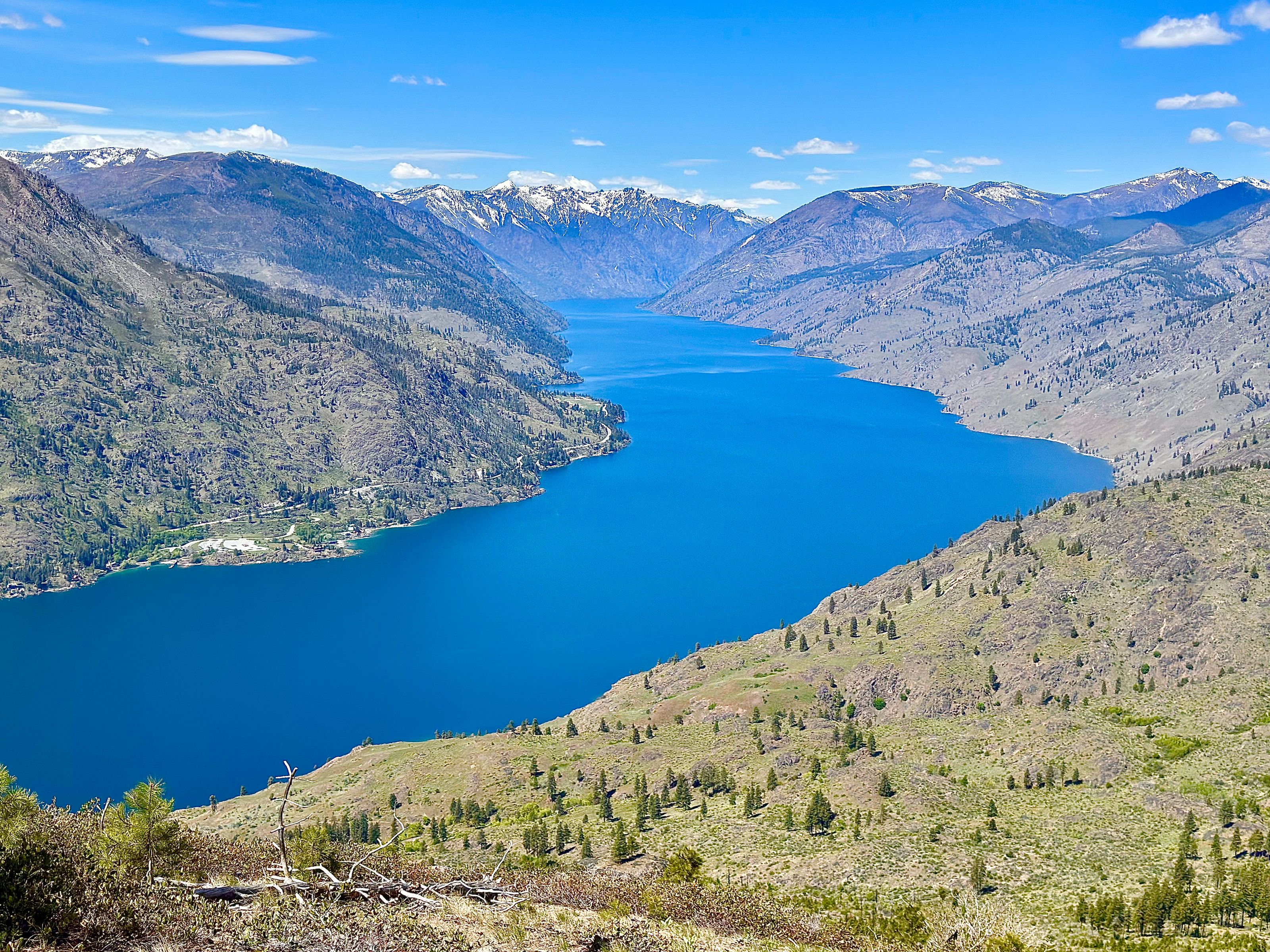
View Trailhead →Lake Chelan — Washington State
Trails for Every Adventure — from easy lakeside walks to challenging summit climbs.
All Things to Do →beExploring / Lake Chelan
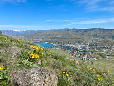
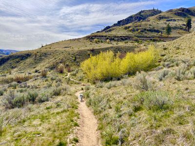
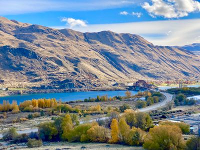
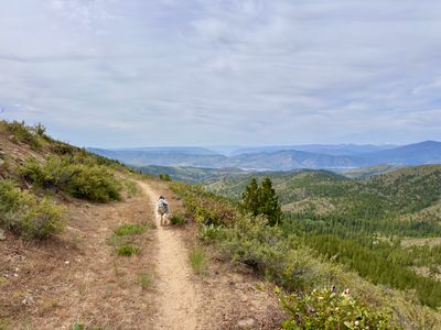
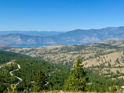
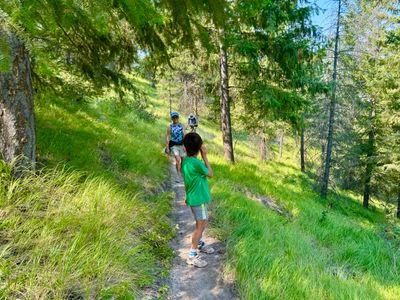
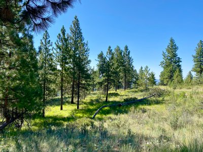
From easy lakeside walks to challenging summit climbs, Lake Chelan offers some of the best hiking in Washington. Whether you're looking for family-friendly trails, epic lake views, wildflower hikes, or the perfect sunrise summit, this guide helps you find the right trail for your trip.
Use our interactive trail map below to explore hikes by location, difficulty, season, and trail type. Or check current trail conditions, weather, and air quality before you go.
beExploring / Lake Chelan
Select a type to jump to the matching trails in the directory below.
beExploring / Lake Chelan
Browse all 28 hikes near Lake Chelan, including car-accessible trails and boat-in hikes accessible from Stehekin. Use the map layers control to toggle between hike pins and trailhead pins, or remove trail lines from view. Filters apply to hikes only — trailheads and trail lines are not affected.

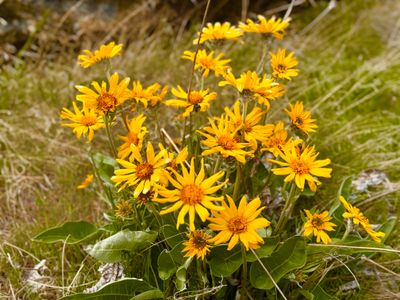
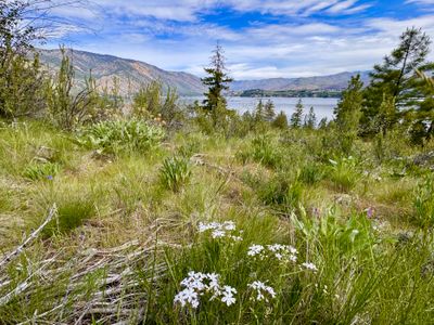
A short but rewarding climb above Manson with spectacular Lake Chelan views and abundant spring wildflowers. The 3.2-mile round trip packs in 1,200 feet of elevation gain, satisfying without committing to a full-day adventure. Best in late spring when the hillsides are covered in blooms.
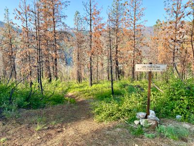
A full-day loop in the mountains above Lake Chelan, reached by a long drive to the trailhead. At 11 miles and 2,600 feet of gain, the ridge delivers panoramic views across both the Chelan and Entiat Valleys and a stand of larches that adds color in fall. A solid outing for experienced hikers who don't mind the commitment to get there.
A walk along the Columbia River with beautiful views of the water and surrounding canyon. Choose your distance between half a mile and 3 miles. At low elevation, this trail sheds snow earlier than most options in the area, making it a good early-season choice. Ideal for families or anyone wanting a relaxed outing. Discover Pass required.
The longest lakeside trail in the Chelan area, stretching 4 miles one way to reach the lake. You don't need to hike the full distance. Going just part of the way still makes for a rewarding outing. For those who make it to the water, it's one of the most unique destinations in the region, accessible entirely by foot. Ideal for backpackers or ambitious day hikers.
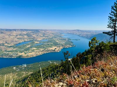
The defining hike of downtown Chelan. The butte dominates the skyline and rewards with a panoramic 360-degree view taking in the full length of Lake Chelan, the Columbia River valley, and surrounding mountains. At 2,700 feet of gain it's a real workout, but the summit payoff is hard to beat.
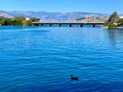
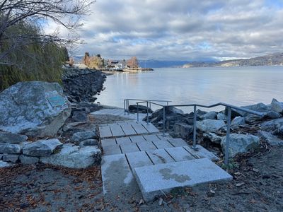
The most accessible walk in Chelan, right on the river and steps from downtown. A flat 1.2-mile loop with lake views and easy river access makes this the default choice for a quick morning walk or an easy family outing. No pass required, minimal effort, high reward.
A fun local trail close to Chelan with a good mix of river scenery and wildflower meadows. The 3.8-mile loop has enough variety to keep kids engaged without too much elevation. A solid option when you want a real hike without driving far from town.
A short loop near Chelan Falls with beautiful views of the Columbia River and surprisingly good elevation gain for its size. At low elevation, the trail sheds snow earlier than most options in the area, a good early-season choice. Discover Pass required.
A gentle riverside loop near Chelan perfectly suited for families and beginners. Minimal elevation, river access, and wildflowers in spring make this an easy choice for a relaxed outing close to town.
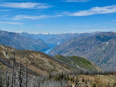
One of the most demanding and rewarding hikes in the backcountry above Lake Chelan, with a challenging ridge traverse and sweeping views of the lake and surrounding peaks. An outstanding larch display adds color in fall. At 11.8 miles one way with significant elevation gain, best treated as an overnight or shuttle hike. The views from the ridgeline are exceptional.
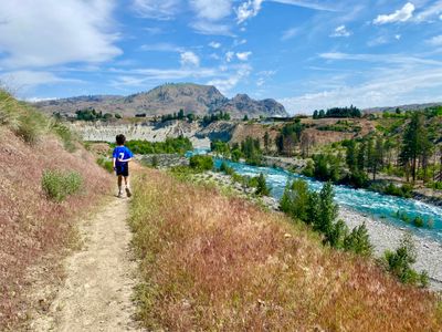
A straightforward riverside hike close to Chelan with gentle elevation and a comfortable out-and-back format. Good for families or anyone wanting a quiet walk near the water without committing to a longer day.

A short, nearly flat loop in the Echo Ridge area above Manson with excellent wildflower viewing in late spring and summer. The elevated starting point at 3,490 feet means mountain scenery without the climb. Northwest Forest Pass required.
A satisfying half-day climb close to Chelan with rewarding lake views throughout the hike. The 4-mile round trip gains 1,200 feet, with views of the water opening up as you ascend. A good workout without committing to a full day.
The easiest trail with direct lake access in the Chelan area. Flat, short, and right on the water, perfect for young kids, casual walkers, or anyone who just wants to reach the lake on foot. Keep in mind the trail parallels the road, so expect some traffic noise. No pass required.
A short, family-friendly trail with wildflowers and lake views that still delivers a real payoff. The 2.3-mile round trip is manageable for most kids. Discover Pass required for parking.
A remote trail that descends from the trailhead down to the North Fork of 25 Mile Creek, with no summit. Good for hikers seeking solitude and a quiet creek canyon without a long drive from Chelan.
A moderate 6.2-mile round trip that follows the Outback Loop before ascending to the summit of an unnamed peak at over 4,300 feet. A great option for hikers who want a longer outing with a genuine alpine feel without pushing into remote territory.
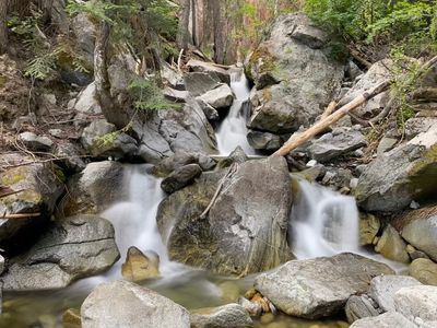
A long river canyon route deep in the Chelan backcountry. The first 2 miles are relatively moderate and pass a small waterfall, making for a nice out-and-back on their own. Going the full 18.6 miles with nearly 4,400 feet of gain is best suited as an overnight backpacking trip. The reward is genuine solitude in a rugged, beautiful canyon.
A pleasant loop in the Echo Ridge network above Manson with lake views and wildflowers. Starting high means the scenery comes early, making it a great afternoon outing when you want views without a grueling climb.
A remote summit hike that sees far less traffic than closer options. At 9 miles and 2,400 feet of gain, there are occasional lake views along the way, though nothing spectacular from the summit itself. A rewarding choice for experienced hikers who want to get away from the crowds.
A family-friendly lakeside walk close to Chelan with wildflowers and good views of the water. The 3-mile round trip is easy enough for older kids and casual hikers yet still delivers a genuine outdoor experience without requiring a drive out of town.
A short, scenic loop in the Echo Ridge area with open lake views and wildflower meadows. Starting from a high trailhead keeps the effort low while delivering classic Eastern Cascades scenery. Northwest Forest Pass required.
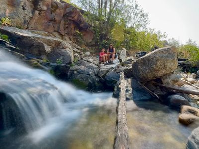
A surprisingly flat backcountry trail in a remote creek drainage with waterfalls and wildflowers. At only 200 feet of elevation gain, Safety Harbor Creek delivers remote wilderness without a punishing climb. A hidden gem for those willing to make the drive.
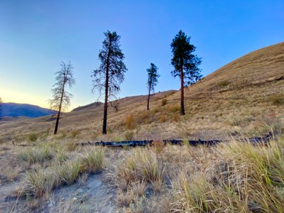
Not a formal hiking trail. Slide Ridge follows an old fire line and is best suited for expert hikers comfortable off trail. The route descends from the trailhead rather than climbs, dropping to over 5,000 feet elevation across 3.8 miles round trip. A remote and adventurous outing for those who know what they're getting into.
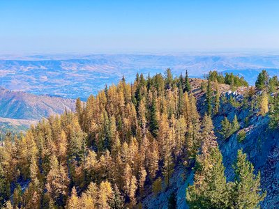
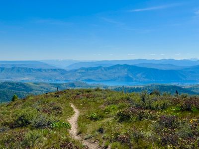
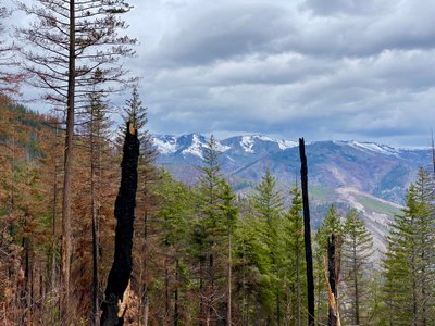
One of the highest accessible summits in the Chelan backcountry, with panoramic views stretching in every direction. At 7,198 feet, Stormy Mountain delivers a true alpine experience with wildflowers, larches, and a summit ridge with unobstructed lake views. A classic for those willing to make the drive to the trailhead.
A short, family-friendly loop in the Echo Ridge area above Manson with lake views and a manageable grade. One of the best introductory hikes for kids in the area. The high trailhead keeps the climb reasonable while the views still feel earned. Northwest Forest Pass required.
The highest summit in this guide and one of the most spectacular hikes in the Lake Chelan backcountry. Uno Peak's 15-mile loop climbs to 7,644 feet through river drainages, wildflower meadows, and larch forests before reaching a summit with views stretching for dozens of miles. Plan for a full day or overnight.
The easiest trail in the Echo Ridge system and one of the most accessible wildflower walks in the area. A flat 1-mile loop starting at 3,460 feet, perfect for young kids, first-time hikers, or anyone who wants to enjoy mountain meadows without any real effort. Northwest Forest Pass required.
beExploring / Lake Chelan
Want the fastest way to choose? Compare the most popular hikes side by side.
| Name | Distance | Difficulty | Elevation Gain | Lake | Best Season(s) |
|---|---|---|---|---|---|
| 4th of July Mountain | 3.2 miles, roundtrip | Moderate | 1,200 ft | Lake Views | Apr – Oct |
| Angle Peak Loop | 11 miles, loop | Strenuous | 2,600 ft | Lake Views | Jul – Oct |
| Beebe Springs Wildlife Area | .5 to 3 miles | Easy | 50 ft | None | Mar – Nov |
| Box Canyon | 13 miles, roundtrip | Hard | 1,800 ft | Lake Access | Apr – Oct |
| Chelan Butte | 7.8 miles, roundtrip | Hard | 2,700 ft | Lake Views | Apr – Oct |
| Chelan Riverwalk | 1.2 mile loop | Easy | 25 ft | Lake Access | Year-Round |
| Coyote Loop | 3.8 miles, round trip | Moderate | 560 ft | None | Mar – Nov |
| Cultus Jim & Chelan Bob Loop | 1.6 miles, loop | Easy | 500 ft | None | Mar – Oct |
| Cutthroat Loop | 3 miles, roundtrip | Easy | 240 ft | None | Mar – Nov |
| Devil's Backbone | 11.8 miles, one way | Strenuous | 3,560 ft | Lake Views | Jul – Oct |
| Eagle Trail | 2.8 miles, roundtrip | Easy | 320 ft | None | Mar – Nov |
| Echo Ridge | 1.4 miles, loop | Easy | 70 ft | None | May – Oct |
| Elephant Head | 4 miles, roundtrip | Moderate | 1,200 ft | Lake Views | Apr – Oct |
| Lakeside Trail | 1 mile, one way | Easy | 20 ft | Lake Access | Year-Round |
| Little Bear Trail | 2.3 miles, roundtrip | Easy | 250 ft | Lake Views | Mar – Nov |
| Lone Peak | 2.5 miles, roundtrip | Moderate | 650 ft | None | May – Oct |
| Mallory's Way | 6.2 miles, roundtrip | Moderate | 820 ft | Lake Views | May – Oct |
| North Fork 25 Mile Creek | 18.6 miles, roundtrip | Moderate | NaN ft | None | Jul – Sep |
| Outback | 4 Miles, loop | Moderate | 500 ft | Lake Views | May – Oct |
| Pot Peak | 9 miles, round trip | Hard | 2,400 ft | Lake Views | May – Oct |
| Reach 1 Trail | 3 miles, round trip | Easy | 300 ft | Lake Views | Year-Round |
| Ridge View Loop | 3.5 mile loop | Moderate | 350 ft | Lake Views | May – Oct |
| Safety Harbor Creek | 6.4 miles, roundtrip | Moderate | 200 ft | Lake Views | Jun – Sep |
| Slide Ridge | 3.8 miles, roundtrip | Moderate | 1,100 ft | Lake Views | Jun – Oct |
| Stormy Mountain | 3.6 miles, roundtrip | Moderate | 1,201 ft | Lake Views | Jul – Oct |
| The Shoe | 2.4 miles, loop | Easy | 355 ft | Lake Views | May – Oct |
| Uno Peak | 15 miles, loop | Strenuous | 4,600 ft | Lake Views | Jul – Oct |
| Whoop-Di-Do | 1 mile loop | Easy | 25 ft | None | May – Oct |
beExploring / Lake Chelan
Traveling with kids? These hikes offer shorter distances, easier terrain, and rewarding views without a major climb.
Reach 1 Trail
Short, scenic, and beginner-friendly with easy access near town.
Riverwalk Trail
Flat, paved, and ideal for strollers, younger kids, and casual walks.
Whoop-Di-Do
A great option for families wanting more of a traditional hike without major elevation gain.
beExploring / Lake Chelan
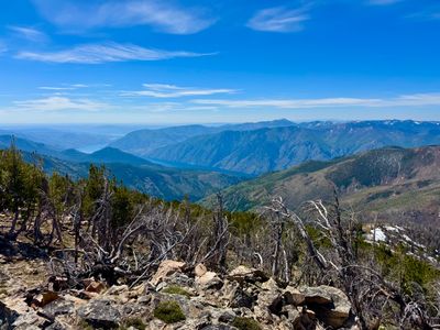
If your goal is unforgettable views of the lake, these are the hikes worth the climb.
Chelan Butte
Classic panoramic views over Lake Chelan and the surrounding vineyards.
Fourth of July Mountain
Moderate hike in Manson with sweeping uplake views.
Box Canyon
New trail with constant lake views and lake access.
beExploring / Lake Chelan
beExploring / Lake Chelan
Browse trailheads around Lake Chelan by name, parking setup, restrooms, and connected hikes. Trailheads with hikes link to dedicated pages with map details and related hike reports.
748 ft
Trails: Toad Creek Trail
View Trailhead →725 ft
Trails: LaChappelle Trail, Grasslands Trail, Discovery Loop Trail
View Trailhead →1,125 ft
Trails: Chelan Bob Trail, Cultus Jim Trail
View Trailhead →2,697 ft
Trails: Berman Gulch, Waterbar Heaven
1,780 ft
Trails: Box Canyon
View Trailhead →1,183 ft
Trails: Chelan Butte Trail, Reach 1 Trail
View Trailhead →6,445 ft
Trails: Summit Trail
6,550 ft
Trails: North Fork 25 Mile Creek, Devil's Backbone Trail, Lake Creek Trail
View Trailhead →2,342 ft
Trails: Fourth of July Trail
View Trailhead →1,140 ft
Trails: Little Bear Trail
View Trailhead →3,613 ft
Trails: Lone Peak Trail
View Trailhead →3,435 ft
Trails: Minor Threat, Somewhere to Ride, Lolly Pop Loop
View Trailhead →2,380 ft
Trails: North Fork 25 Mile Creek
View Trailhead →3,512 ft
Trails: Outback, Bergman Gulch, T Bone, Dust To Glory
View Trailhead →1,909 ft
Trails: Pot Peak Trail
View Trailhead →1,164 ft
Trails: Reach 1 Trail
View Trailhead →4,330 ft
Trails: Lower Safety Harbor Trail
6,398 ft
Trails: Summer Blossom Trail
2,837 ft
Trails: Switchback Alley
3,238 ft
Trails: The Shoe, Shoe Spur
View Trailhead →3,485 ft
Trails: No-Where to Hide, Upsy Daisy, Nuthatch
View Trailhead →6,120 ft
Trails: Devils Backbone Trail
View Trailhead →beExploring / Lake Chelan
Turn your hike into a full day in Chelan. After your hike:
beExploring / Lake Chelan