Click on an item on the map to view information about it

Devil's Backbone
Chelan,
Washington
overview
LENGTH : 11.8 miles, one way
ELEVATION GAIN : 3,560 ft.
TYPE : hike
HIGH POINT : 7,150 ft.
The trail follows the Devil's Backbone spine, which splits the Lake Chelan and Entiat Valleys, for close to 12 miles all above 6,000 feet in elevation. Due to the long drive on forest service roads to the trailheads on either end, the trail is more popular with motorbikes than hikers, but it offers sweeping views of the area, including Glacier Peak and Lake Chelan. While the trail is a little long for most people to hike in its entirety, on the southern end of the trail is Stormy Mountain, which makes for a very moderate outing. While one can summit Angle Peak from the northern end of the trail, and make a loop out of it by following Angle Peak and Lake Creek Trail.
Placeholder in dev for ad
Directions
Parking
Trip Reports
TOTAL MILEAGE : 7.75 miles, roundtrip
ELEVATION GAIN : 1,702 ft.
HIGH POINT : 6,887 ft.
Since my brother was in town for his first visit to Chelan, I wanted to take him out for a nice hike in the area. I had been keeping an eye on Stormy Mountain for a gauge on how much snow was left at higher elevations and it looked like almost all the snow was gone, so I figured it would be a good opportunity to head up to Crescent Hill Trailhead. I hadn't been there yet, and there looked to be a fun loop to Angle Peak via Devil's Backbone, Angle Peak and Lake Creek trails.
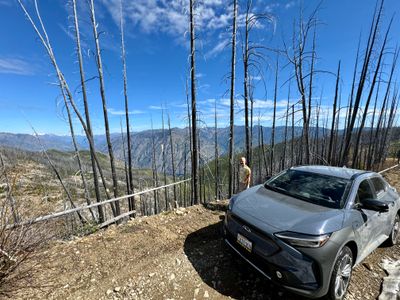
The drive up to Crescent Hill is quite impressive, traversing along a number of ridges. But as we progressed up the road I was noticing more snow in higher peaks, especially anything facing north. Sure enough, about 2 miles from the trailhead we were stopped by large snow drifts on a section of the road which crossed below Junior Point campground on a northern aspect.
My brother took it in good stride, but I was a little disappointed I hadn't anticipated this - I probably could have called the Chelan Ranger district for any beta on the road, as it looked like they had been clearing downed trees from the road not long ago. After checking the map and seeing we weren't too far from Crescent Hill Trailhead, we decided to hike along the road.
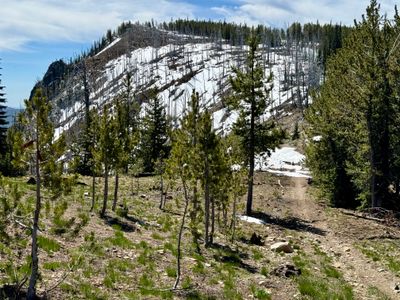
Start of the hike
After passing through a couple hundred feet of snow covered road, the snow dissipated and for the most part we were able to walk on dirt, although we ran into occasional sections that were completely covered in snow. I'm guessing its a couple of weeks until it's snow free, and there was also a decent sized down tree across one section of the road. But it was easy walking, and soon we were passing by the Junior Point Warming Yut.
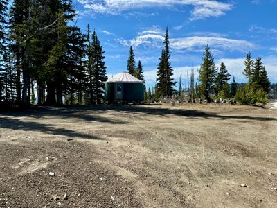
Junoir Point Warming Yurt
Upon reaching the Crescent Hill trailhead, we decided to proceed onto Devil's Backbone but skip doing the Angle Peak loop, as a good section of the trail was covered in snow. We stuck to the dirt when we could, and most snow covered sections were ok, looking like they had been packed down by snowmobile traffic during the winter, however every once and while we would post hole through the snow, which isn't the most fun thing when you are wearing shorts!
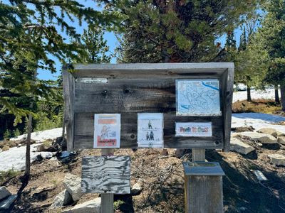
Crescent Hill Trailhead
Once we climbed up onto the ridge, there was less snow and soon we passed by the junction of Devil's Backbone and Lake Creek trail. Besides the snow, the trail was in good shape. I was a bit bummed we probably wouldn't reach Angle Peak, but it's an impressive trail, with views all around.
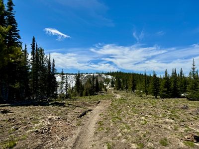
Snow free section of Devil's Backbone
As the trail headed down a little ways, we consulted the map and figured a prominent rock outcropping up ahead, marked on the map as East Point, would be a good turnaround spot. While there was a lot more snow again on the section leading up to the high point, it looked like a nice place to take a break and catch some views.
Heading to East Point
The hike up along the snow covered trail resulted in a lot of postholing, and we decided to venture off the trail and bushwack along the ridge where we could more or less stay off the snow. We took a nice break on East Point, with a great view of Glacier Peak off in the distance.
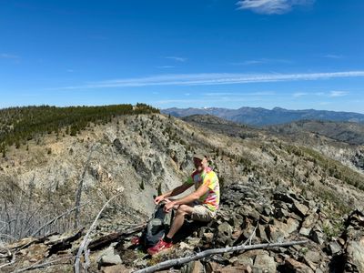
My brother on East Point
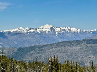
Glacier Peak
After water and food, we retraced our steps back along Devil's Backbone to the Crescent Hill Trailhead. Upon reaching the Junior Point Warming Yut, we opted to head up the forest service road to the Junior Point Campground to check it out. Unbeknownst to me, there was the remains of an old fire lookout at the campground, and it provided great views over the Chelan Valley. We noticed some smoke up lake, which was odd as the burn ban just went into effect on June 1st.
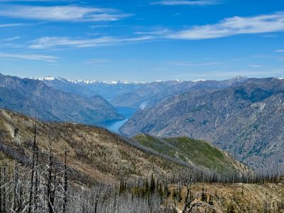
Lake Chelan and Pioneer Fire
We later came to realize that was the start of the Pioneer Fire, with someone first reporting it about an hour before we spotted it. I honestly didn't think it was a forest fire, given how early in the season it was, and the fact that the smoke looked to be coming from very close to the shoreline. But next time I see smoke in the mountains, I will be sure to report once back in cell phone range.
Not wanting to hike back to the warming yurt, we bushwhacked down the ridge to directly connect back up with the road, and along the way back passed a group of three motorbikers trying to make their way through the snow that had blocked my car. All in all, a good hike given the failure to reach the trailhead. I won't make the assumption that the roads at that high elevation are snow free, even when it appears there is no snow on Stormy Mountain - in fact, the north side of Stormy still had a good amount of snow, I just can't see that aspect from Manson...
beExploring / Entiat
Comments
0No comments yet. Be the first to share your thoughts!