Click on an item on the map to view information about it
beExploring · Trip Reports · Washington · Chelan
Mallory's Way
A moderate 6.2-mile round trip that follows the Outback Loop before ascending to the summit of an unnamed peak at over 4,300 feet. A great option for hikers who want a longer outing with a genuine alpine feel without …
Plan This Trip
At a Glance
straighten
Distance
6.2 miles, roundtrip
trending_up
Elevation Gain
820 ft
landscape
High Point
4,323 ft
backpack
Activity
Hike
Best For
WildflowersDogs AllowedNo Pass RequiredLake ViewsMid-DistancePhoto Highlights · April 2024
Jump to Trip Report →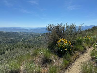

Plan This Trip
Why Go
Mallory's Way is a moderately strenuous loop hike at Echo Ridge with views of Lake Chelan, the surrounding mountains and even the Waterville Plateau . From the North Junction Trailhead you will head north on the Outback trail, (you can also hike up / down Waterbar Heaven and hook back into Outback), after roughly a quarter mile Outback turns into a loop, either direction is fine for this hike. You will find Mallory's Trail on the west side of the mountain. Proceed up Mallory's trail until it splits, as the upper section of Mallory's Trail is also a loop. The best views of Lake Chelan are while hiking up the ridge prior to getting near the high point. Look for a summit register nestled in the rocks at the top.
Placeholder in dev for ad
Plan This Trip
Route & Map
Plan This Trip
Getting There
directions_car
Directions
From Chelan, take WA-150/W Manson Rd for approximately 2 miles. A short ways after the traffic circle, turn right onto Boyd Road. Continue on Cooper Mountain Road and then Cooper Gulch Road and finally onto Echo Ridge Forest Service 8021 Rd/NF-8010. In a couple of miles take a left to stay on Echo Ridge Forest Service 8021 and the The North Junction Trailhead will be on your right.
local_parking
Parking
The North Junction Trailhead has parking spots for roughly five cars, although it is rarely ever full. Unlike other trailheads at Echo Ridge, no fees or passes are required to park here.
edit_note
Field Notes · Personal Trip Report
Revisiting Mallory's Way
Years after that quick family detour with my young son, I returned to Echo Ridge on a lazy Sunday to finally hike the full loop and catch distant views of Mount Stuart and Devil's Backbone.
calendar_today April 28, 2024
straighten 6.2 miles, roundtrip · 820 ft gain
chat 0 comments
The only other time I had been up Mallory's Way was a number of years ago before moving to the area while on a family hike on Outback. I think my son was 5 years old, and I broke off from the family to quickly hike up Mallory's and then eventually caught back up with them. I had a little free time on a Sunday morning and decided to revisit.
I started up Outback and then broke off onto Waterbar Heaven for a change of pace. Once at the start of the Outback loop, I decided to head counter clockwise, to start off the hike with views of the lake. But I think either direction is fine, just a personal preference on my part.
Starting the loop
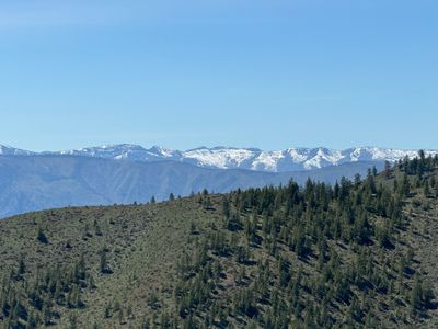
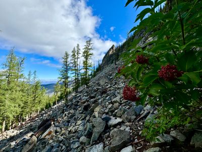
As I made my way around I could see Mount Stuart way off in the distance as well as Devil's Backbone. I wish I had paid more attention to the amount of snow on Devil's Backbone, because over a month later I ran into snow on the road on my way to hike around the area with my brother!
Devil's Backbone
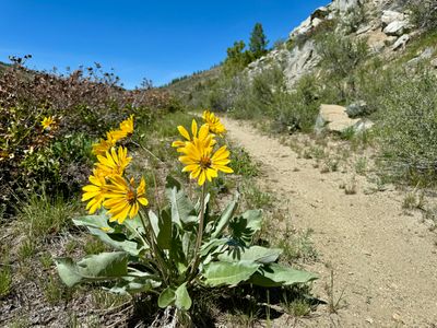
I was surprised by the lack of wildflowers. There were some arrowleaf balsamroots still in bloom, and a couple other varieties like phlox, but the Echo Ridge area seemed to be much drier than I was expecting. I guess we had a fairly dry spring, and it was noticeable up here.
Arrowleaf balsamroot
Before I knew it, I was at the junction with Mallory's Way, and proceeded to hike up. The hike had been relatively flat until this point, but now progressed steadily up. I could make out some mountain bike tracks on the trail, and once I get a little more comfortable on my bike, I will have to try it out.
Heading up Mallory's Way
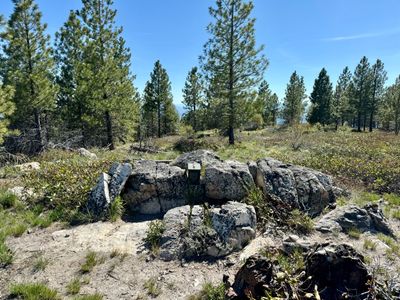
Once at the start of the loop, I headed counterclockwise again, although I really don't think it matters which way you go. Upon reaching the top, I surprisingly found a summit register and entered my name. My only other time up I didn't see it, but I can't say I was looking, as this isn't a prominent peak in the area.
Summit register
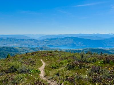
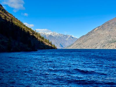
After a quick water and food break, I continued on the Mallory's Way loop and wound around the other side of the mountain. As I headed back down towards Outback there were nice views of the lake.
Lake Chelan
I finished on Mallory's Way and then continued the loop on Outback and made it back to the car. I was surprised to see it was a little over 6 miles, although not a lot of elevation gain. It's a nice moderate hike at Echo Ridge and one I will surely do again.
Comments
on this trip report · Apr 2024
More From The Area
Nearby Trip Reports
beExploring / Lake Chelan
Comments
0No comments yet. Be the first to share your thoughts!