Click on an item on the map to view information about it
beExploring · Trip Reports · Washington · Chelan
North Fork 25 Mile Creek
A long canyon route deep in the Chelan backcountry. The first 2 miles are relatively moderate and pass a small waterfall, making for a nice out-and-back on their own. Going the full 18.6 miles with nearly 4,400 feet o…
Plan This Trip
At a Glance
straighten
Distance
18.6 miles, roundtrip
trending_up
Elevation Gain
4 ft
landscape
High Point
6,749 ft
backpack
Activity
Hike
Best For
WildflowersDogs AllowedNo Pass RequiredRiverWaterfallRemotePhoto Highlights · June 2026
Jump to Trip Report →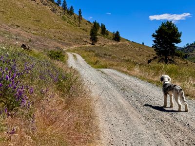
Plan This Trip
Why Go
The North Fork 25 Mile Creek trail intersects with the Devil's Backbone Trail after 9.3 miles and over 4,000 feet of vertical gain and the full trail is typically done as part of a multi-day backpacking trip (or as a descent on a mountain bike). However, the lower section of the North Fork 25 Mile Creek trail makes for a great day hike, and is well suited to families. The first couple of miles have minimal elevation gain, and follow the creek through a mixture of forest and more open areas. The Lone Peak tail intersects at 2.25 miles, and can be combined with The North Fork 25 Mile Creek for a moderate hike.
The trail begins a couple hundred yards up the road from the parking lot, and proceeds through open meadows with minimal elevation change on what used to be an old road. After little more than a mile in, you will enter a more forested area and reach the creek. Below is a small waterfall, and may notice some pipes which were used to send water to the Hale homestead a mile away. The trail continues along the creek, and has some short ups and downs. At 2.25 miles, you will intersect with the Lone Peak trail, and shortly thereafter the trail leaves the forest and then fords the North Fork 25 Mile Creek (no bridge) and there begins the majority of the elevation gain as the trail covers 6.5 miles on its way up to Crescent Hill.
The trail begins a couple hundred yards up the road from the parking lot, and proceeds through open meadows with minimal elevation change on what used to be an old road. After little more than a mile in, you will enter a more forested area and reach the creek. Below is a small waterfall, and may notice some pipes which were used to send water to the Hale homestead a mile away. The trail continues along the creek, and has some short ups and downs. At 2.25 miles, you will intersect with the Lone Peak trail, and shortly thereafter the trail leaves the forest and then fords the North Fork 25 Mile Creek (no bridge) and there begins the majority of the elevation gain as the trail covers 6.5 miles on its way up to Crescent Hill.
Plan This Trip
Route & Map
Plan This Trip
Getting There
directions_car
Directions
From South Lakeshore Road, take a left onto Shady Pass Road. In roughly 2.5 miles the road will turn to dirt, continue on this road for 1 mile, and find the parking area on your left at the first switchback (the trailhead is farther up the road).
local_parking
Parking
There is a small parking area with enough room for a couple of cars at the first major turn on Shady Pass Road after the road turns to dirt, and no fees required to park here. The trailhead is a couple hundred yards up Shady Pass Road on your left.
edit_note
Field Notes · Personal Trip Report
2
Trip Reports
I've hiked North Fork 25 Mile Creek twice — pick a visit to read its full report.
A hike for a hot day
My brother and I took Summit out for a hot-day creek hike, making it past the Lone Peak junction and across the ford before turning around at 3.5 miles — less shade than expected but the creek kept the dog cool.
calendar_today June 17, 2026
straighten 7.2 miles, roundtrip · 1,300 ft gain
chat 0 comments
My brother was in town after working in Spokane and we wanted to get out for a hike in the area. On his last visit a year ago, we had ventured deep into the surrounding mountains and ran into more snow than expected. With the poor snow year, that wasn't likely to happen again, however I wanted to spend a little less time driving and opted for North Fork of Twenty Five Mile Creek. I had my dog Summit with me, and figured with the hot temps, hiking along a creek would help him cool down.
We arrived at the trailhead, and there were no other cars there. Given it was a weekday and the trailhead is a ways outside of Chelan, I wasn't too surprised. We saw a couple of motorbikes coming down the forest service road at the start of our hike, but otherwise we didn't encounter anyone while on the trail.
Walking up the road to the trail
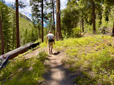
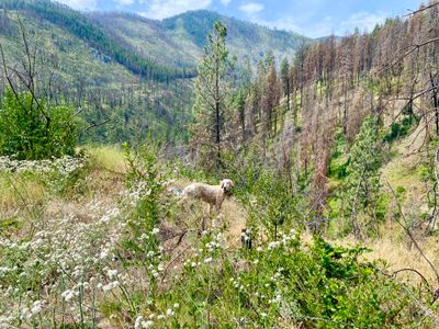
We walked up the road, and began hiking on the trail. I had thought there was a bit more shade on the hike. While there is an occasional tree or two providing a little break from the sun, there aren't any real sustained shady sections. There are quite a few burnt trees along the way, so I suspect prior to whatever forest fire hit the area, there may have been more shade. Fortunately my puppy was able to wait for us under trees and bushes when he got a little ahead, and he seemed to be doing well in the heat.
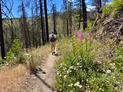
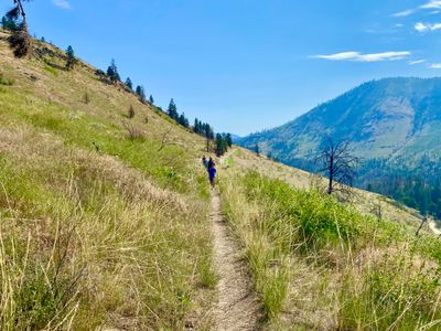
Wildflowers and burnt trees
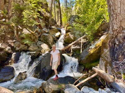
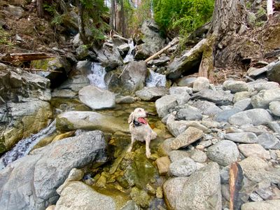
There were a decent amount of wildflowers still out, with fireweed really starting to show. We ran into the occasional lupine still in bloom, and saw a little bit of indian paintbrush starting to flower. Farther into the hike I spotted the dried out tweedy lewisia - I had seen some in bloom for the first time a number of years ago on this trail - but it was too late in the season now. Before long we were at the small waterfall, and we descended down the rocks to snap some photos and let my dog get into the water to cool off and hydrate.
My brother in front of waterfall
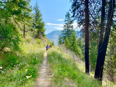
The trail climbs steeply after the waterfall. Not for very long, it's probably only a couple hundred feet if that, but it's steep and without switchbacks. With the loose dirt on the trail, coming back down proved most difficult, but we were able to navigate it without falling down. The trail leveled out and continued along next to the creek, and my dog found an occasional spot to quickly descend into the water.
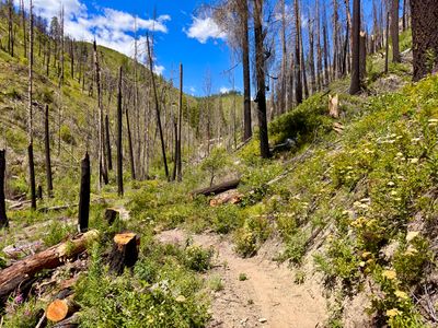
Trail ahead of us
At a little over 2.5 miles from the start of the hike, we reached the junction with the Lone Peak trail. We opted to head back down to the creek for a break, snacking on some food and hydrating, and discussed whether to keep hiking. My dog was doing well in the heat, helped by the occasional dip in the creek, and we decided to keep on hiking.
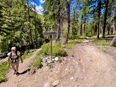
Junction with Lone Peak trail
The trail continued following the creek for roughly three quarters of a mile before crossing the creek. This was the farthest point I had been on the trail, and the last time I was here, the creek had a lot more volume and crossing would have required getting wet. This time we were able to make it across on some rocks and we started to ascend up a new drainage. This section of the trail was nice, passing through some open forest. At around 3.5 miles I decided we should probably head back.
Turnaround point
We descended back to the creek crossing, made our way across and started hiking back along the trail. It was very dusty on the trail, with clouds of dust rising whenever my dog would speed on by. But other than that, the trail was in good shade, with not a single blowdown encountered.
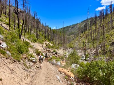
Heading back
Soon we were back at the car, and ready to head home and jump in the lake to get all the dust off of us. It's a nice hike, and I want to explore further up the trail. It would be fun to take it up to Devil's Backbone and then down Pot Peak for a loop, but I think that's a lot more mileage than I can do in a day, so it would probably have to be an overnight trip. One of these days...
Comments
on this trip report · Jun 2026
More From The Area
Nearby Trip Reports
beExploring / Lake Chelan

Comments
0No comments yet. Be the first to share your thoughts!