Click on an item on the map to view information about it
beExploring · Trip Reports · Washington · Chelan
Reach 1 Trail
A family-friendly lakeside walk close to Chelan with wildflowers and good views of the water. The 3-mile round trip is easy enough for older kids and casual hikers yet still delivers a genuine outdoor experience witho…
Plan This Trip
At a Glance
straighten
Distance
3 miles, round trip
trending_up
Elevation Gain
300 ft
landscape
High Point
1,030 ft
backpack
Activity
Hike
Best For
WildflowersDogs AllowedNo Pass RequiredKid FriendlyLake ViewsClose to TownPhoto Highlights · August 2021
Jump to Trip Report →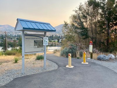
Plan This Trip
Why Go
The Reach One trail, completed in 2010, comprises a couple of different sections, the first one being a half mile paved trail which starts near the boat launch and goes past the Chelan Dam. The trail then turns into gravel, and proceeds down to the Chelan River. There are a number of interpretive signs along the way, providing information about the history of Chelan. It's a great hike for families and is conveniently located 5 minutes outside of downtown Chelan.
You have the option of walking the entire trail by starting near the boat launch. This requires walking along Farnham Ave / Saunders St, and taking a left on E Raymond Street, where you will find the paved trail at the end of the street. Or start at the Chelan Butte trailhead to walk the gravel trail. Reach One provides access to the Eagle Trail, and Cutthroat and Coyote loop trails.
You have the option of walking the entire trail by starting near the boat launch. This requires walking along Farnham Ave / Saunders St, and taking a left on E Raymond Street, where you will find the paved trail at the end of the street. Or start at the Chelan Butte trailhead to walk the gravel trail. Reach One provides access to the Eagle Trail, and Cutthroat and Coyote loop trails.
Placeholder in dev for ad
Plan This Trip
Route & Map
Plan This Trip
Getting There
directions_car
Directions
From Chelan, take the Sanders Street Bridge across the river and take your first left on E Farnham Ave. Look for parking here, as there is no parking at the start of the paved trail. Otherwise follow Farnham Ave, which will turn into Saunders St. Turn left onto E Iowa St, and you will see the Chelan Butte parking lot on your left in .2 miles.
local_parking
Parking
If starting from the Lake Chelan Boat Launch, there is free parking available along E Farnham Ave. There is free parking available at the Chelan Butte Trailhead as well.
edit_note
Field Notes · Personal Trip Report
Smoke Clears, Trail Opens
After a week of heavy smoke from regional fires, I drove up from Manson early and discovered the informational signs marking Chelan's unique planet-themed Riverwalk during my first time on this family-friendly route.
calendar_today August 4, 2021
straighten 3 miles, round trip · 300 ft gain
chat 0 comments
The smoke from the Cub Creek 2 and Cedar Creek fires around Winthrop had dissipated, providing my first opportunity in the week to get out for a hike. Getting up early and making the 25 minute drive from Manson, I was able to get a nice, quick hike in before work.
This was my first time hiking the Reach 1 trail, and I was unsure where to park. I had seen some information indicating I should park at the Lake Chelan Public Boat Launch, while other sources mentioned parking at the Chelan Butte Trailhead. I opted for the Public Boat Launch, and had to walk up a couple of streets before I reached the trailhead for the start of the Reach 1 trail.
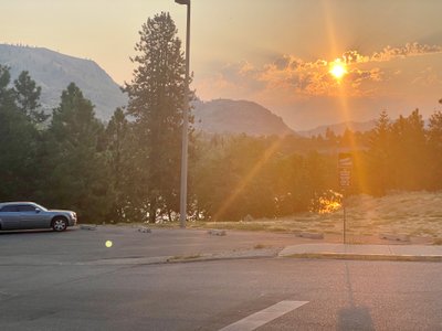
Morning sun and haze at the Boat Launch
Trailhead for Reach 1 Trail
At the trailhead, I was happy to find an informational sign about the planet Uranus. The Chelan Riverwalk trail has signs for each planet, and my son really enjoyed learning about all the planets last summer over the course of a couple of walks on the trail; however we were never able to find Uranus. You can imagine my delight when I was able to text my wife “I have finally found Uranus”. Anyways... this section of the trail is paved, and there are a number of interesting Vignettes posted along the trail that provide great history about the area, as well as the dam, so it’s worth walking this section at least once.
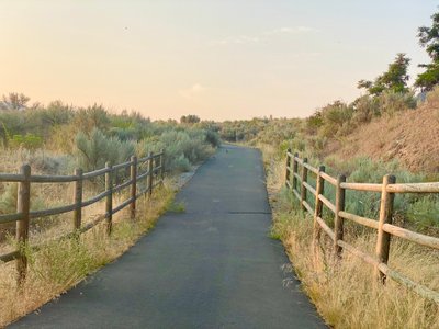
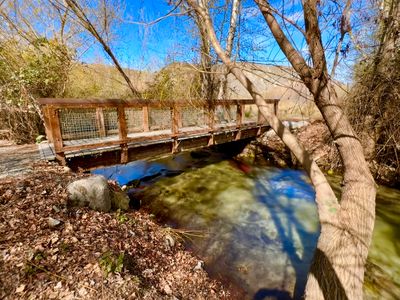
Paved section of the Reach 1 Trail
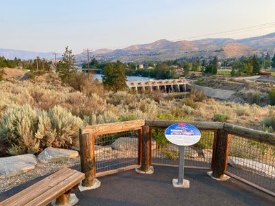
Lake Chelan Dam
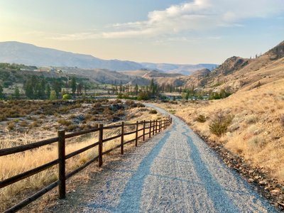
At the Chelan Butte Trailhead, the trail turns into gravel, although it is still quite wide. You parallel the road for awhile, before starting your descent towards the river. Interesting fact : Chelan River is the shortest river in Washington State at 4 miles long. There is an opportunity venture off on a side trail, but I opted to stay on the main trail and make my way down to the river.
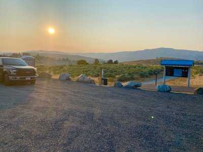
Chelan Butte Trailhead and start of the Reach 1 gravel trail
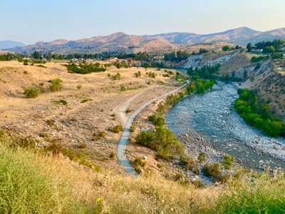
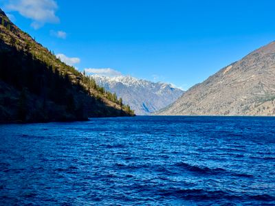
Lake Chelan River
Reach 1 Trail heading down the the Chelan River
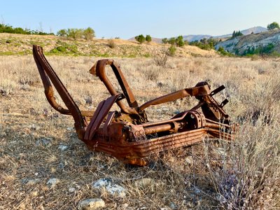
Old rusted out metal near Chelan River
After ascending down into the Chelan River Valley, I noticed a number of hunks of rusted metal. Up on the hillside, it looked like the area might have been an old dump. I walked to the end of the trail and then took a nice break at the river. I can only imagine what the River was like prior to damning the lake and controlling the flow. The steep walls of the River Valley certainly gave an indication.
My final stats for the walk were 3.61 miles and 322ft of elevation gain. A great easy hike 5 minutes from Downtown Chelan, and one that I am sure I will take again.
Comments
on this trip report · Aug 2021
More From The Area
Nearby Trip Reports
beExploring / Lake Chelan
Comments
0No comments yet. Be the first to share your thoughts!